Thursday, 10 July 2014

GaugeMap displays latest River Kennet levels

I've some catching up to do on the Kennet after a few months absence, but for a quick restart this evening there's a new offering from Shoothill which utilises the EA's river level gauges and Google's map to create GaugeMap.  Fairly self explanatory...


Zoom map into desired gauge location.


Click on icon for a graphical display of recent and current river level.

Saturday, 1 March 2014

Current Kennet levels would present a considerable additional challenge to DW 2014

Although this blog isn't primarily focused on either the canalised cuts of the Kennet Navigation (although they are an inevitable part of most trips on the river) or competitive racing, I thought I'd use the rare sunny morning to take a look at a few sections after yesterday's post on the cancelled Waterside and Thameside races on the Kennet.

The Waterside Series website provides a number of race training advice guides.  One of these makes reference to the point downstream from Hamstead Lock where the riverine Kennet flows out of The Craven Fishery from the left, crosses the canal, and exits down Benham Weir. I've never experienced any particular difficulty when paddling here, and had to actively pull myself over the lip of the weir by holding on to the footbridge above in order to descend the weir face. That might not have been the case this morning.


The first problem was getting down to Marsh Benham from the A4 with the road closed from just below The Red House junction on Milkhouse Road to the railway line.

Once down at Benham Weir the cross-canal flow of the river was clearly visible.


The central weir was shortened in its fall height by the raised river level below, and whilst peering back under the footbridge it looks reasonably calm up on the canal, with the side sluices both opened there's a fair amount of water being transferred.

Some miles downstream to the east of Newbury, the water around Bull's Lock (only applicable to Waterside B if it runs, and the Devizes to Westminster International Canoe Race (DW), 18-21.04.14, or anyone training in the area) is still pretty high.  The section below Bull's Lock combines the water of the canal and riverine Hambridge loop (the latter of which is swelled by the inflow of the River Lambourn) in a single channel to just before Widmead Lock.  Talking to a couple of DW trainees from Sussex at Woolhampton today (see below), who were about to return to Newbury, they mentioned having had a couple of 'issues' at Bull's Lock, and I suspect this section would have been something of a slog heading back upstream.


Looking back upstream towards Bull's Lock, which is overlapping the banks immediately below the lock.


Before reaching Widmead Lock the Kennet Navigation is bank full and has even breached the towpath (river left)...


...whilst river right the fisherman's footpath is substantively underwater, although a heavy cut back of the trees on this side of the river has removed a number of potentially hazardous obstacles.

Still further downstream, the Rowbarge pub sits alongside both the Navigation and a riverine Kennet channel which feeds in just below Woolhampton Lock.  Once again, the combined water flow can be considerable, especially in such as the current levels.


The riverine channel has recently flooded the lawn to the west of the Rowbarge...


...although the water is now beginning to feed back to the river.


Although this riverine section is not part of any race course, the resulting flow undercuts banks...


...and presents considerable left bank tree ensnarement risk.


For those portaging the lock (or support crews), the downstream concrete embankment (over the footbridge which crosses the riverine section's confluence with the Navigation) is currently inundated.

By the time contestants reach the edge of Reading at Fobney, conditions have not noticeably improved.


Despite the saw tooth weir to the west of Fobney Wetland Reserve diverting a substantial amount of the flow and water volume...


...the canal cut before Fobney lock is still sufficiently high to have caused several small breaches which are barely contained by sandbagging efforts. 


Whilst the lock itself has been overwhelmed...


...it is still possible to egress the waterway (river right), or to put-in in the case of these intrepid DW trainees today.

However, returning to the water downstream of the lock is problematic at the current water levels.  The official DW portage diagram describes re-entering the Navigation by passing under the footbridge to the left side of the riverine loop to put in.


This image shows the space and bank side route under the bridge in January 2009. 


2014 may require SCUBA for re-entry at current water levels.

Finally, this is well worth reading from among the many amazing DW performances.

Friday, 28 February 2014

Kennet conditions cause cancellation of Waterside A and Thameside 1

The annual Waterside series of races is under threat as record breaking high water levels and flow rates continue to dominate conditions on the River Kennet and the Kennet and Avon Canal.

The first race, Newbury Canoe Club's (NCC) Waterside A, which was scheduled to have run last Sunday (23.02.14) was cancelled following advice from the Canal and River Trust, with Reading Canoe Club's Thameside 1, due to have been held this coming weekend (02.03.14), now also cancelled.


NCC's Waterside B is due to be held on Sunday 9 March 2014, but it "will be cancelled unless conditions improve", according to the race series website.  The NCC website is also advising that "only experienced crews to train on most of the K&A Canal at this time and especially avoid Kintbury through to Reading."

Saturday, 8 February 2014

New record high water and warnings for the Lower River Kennet

Almost a month on from the last post which recorded what was then record-breaking high water levels, and the River Kennet has continued to experience substantial flow rates and over-topped banks making canoeing and kayaking an unusually risky venture on this normally benign waterway.

As of today the Canal & River Trust continue to advise that "We would not recommend navigation until further notice" with regard to the Kennet between Newbury and Reading.  


In additional advice updated last Tuesday (04 February 2014) it is noted that "Due to high flows and flooding along the canal from Kintbury to Reading, the Canal and River Trust advised on 24th December that the canal is unsuitable for navigation until further notice. 

From Kintbury down to the end of the canal in Reading the water can be particularly hazardous for boats, including canoes and kayaks, during current conditions. Sluices and weirs, like the one at Dreweatt’s Lock where we have already recorded canoe incidents during the last week, are running at full capacity and will draw boats (including large narrow boats) onto them. Sluices and weirs have the potential to disguise underwater obstructions, and can create irregular underwater turbulence that is not present in normal conditions. Feeder streams, like the Pear Tree Brook and the River Kennet, create significant turbulence where they enter the canal. 

Additionally, much of the canal infrastructure is currently submerged and therefore impossible to use; for example County Lock (Reading), Widmead Lock (Newbury), and Fobney Lock (Reading). Many landing stages and extensive lengths of towpath are currently being overtopped. Finally, extremely high flow rates are hazardous; the flow rate in Newbury is currently exceptional and canoes have had difficulty negotiating Ham Bridge, Newbury, where portage is not presently an option."

At 04:30 this morning the EA gauge at Barbel Bar was at 1.59m, beating the 1.57m record level previously recorded at this location, but by then it was already falling off slightly from a late night plateau. 


The approach along Arrowhead Road to Barbel Bar at just after 09:00 this morning...

...and the weir washed out.

By 10:30 this morning the gauge was down to 1.54m, but there's more rain on the way...

Sunday, 12 January 2014

New Year high water on the River Kennet

It's a year to the day since this blog reported on high New Year water levels on the Kennet Navigation, and it would appear that history is repeating itself with bells on in 2014.  Local media reported on some record levels in Newbury earlier this week, but whilst the Environment Agency's gauges show a falling off over the last 48 hours, conditions on the lower reach have given cause for the Canal & River Trust to recommend against navigation between Copse Lock in Newbury and County Lock in Reading until further notice.  Riverine sections of the Kennet should be given similar consideration.

Victoria Sluices, Newbury, with the normally exposed left bank concrete side bars covered.
 
Footpath closure at Bulls Lock swing bridge.

Submerged work flat barge upstream of Bulls Lock swing bridge.

Below Bulls Lock, the footbridge over the confluence with the riverine Hambridge detour has limited headroom at this level of water.

Upstream of Padworth Road Bridge...

 ...and downstream, with water in the fields showing where the river has breached.

The River Kennet adjacent to Padworth Lane.

The canal cut and river below Tyle Mill.

Debris caught on Sulhamstead Weir footbridge.  Note that whilst sometimes negotiable, there is currently insufficient headroom under the bridge.

The canal cut below Sulhamstead Weir has a couple of breaches which are filling the fields to the right.
 
Barbel Bar is just about all washed out, but was providing the venue for a Flood First Responder training course for Berkshire Lowland Search and Rescue today.

Full flow under Burghfield Bridge.

Floodwater in the fields beyond the Navigation past Southcote Weir.
 
Haven't been down here for a while: Southcote weir with a new(ish?) barrage.

The wier pool below Southcote Weir #1.
 
The weir pool below Southcote Weir #2.

Monday, 7 October 2013

Kennet MP sacked from DEFRA waterways ministerial post.

A Government reshuffle has today seen Newbury MP Richard Benyon removed from the post of Parliamentary Under Secretary of State at the Department for the Environment, Food and Rural Affairs (DEFRA), where his remit included responsibility for inland waterways.

Despite the surprise departure of LibDem Scotland Secretary Michael Moore less than a year before the referendum on Scottish independence, the sacking of Mr Benyon is not thought to be a result of his failure to progress DEFRAs  consideration that English and Welsh constituents may enjoy a legal Public Right of Navigation (PRON) which would place them on par with the electorate in Scotland. 

As environmental gaffes and apparent support to vested countryside landowning interests (you may remember something about buzzards, carbofuran, quarrying, ragwort, sea fish (he was the Fisheries Minister too), and Walshaw Moor) have previously seemed to be insufficient reason to remove David Cameron's cousin's riparian Kennet riverside neighbour from office, you might wonder why now (badgers might have been the final straw), or if this presages a genuine change in the Government's approach to its citizens.

Let's briefly give George Eustace, who is Richard Benyon's replacement, the benefit of the doubt accorded to a relatively unknown player in the access debate, and trust that he will be supporting the wider populace rather than the anachronistic few.  Don't hold your breath though, as the status quo elitist position of access denial remains a dominant theme in our political society, and will deserve further rebuttal if the new man proves to be a conservative clone.

The good news with regard to canoeing and kayaking on the River Kennet is that during Mr Benyon's time in office there was no meaningful challenge to the idea of a PRON, and the Benyon's Estate were forced to admit that "the entire stretch is fully navigable by water craft".  You might want to consider this statement if you've read this relatively recent and unusually limited thread from the Reading and District Angling Association.

Happy paddling!

UPDATE

George Eustace may not be the Minister of primary interest to paddlers after all.  Another Cornwall MP, Dan Rogerson, has also been appointed to DEFRA, and the division of the portfolio is as yet unclear.  The Countryside Alliance has reported that "George Eustace will be taking on the farming & animals brief, Dan Rogerson water, forests & climate".  Where responsibility for inland waterways and access will sit is as yet unclear. 

Wednesday, 28 August 2013

Northcroft Stream blocked by FAS works

The delayed completion of works intended to protect central Newbury from 1-in-a-100 year extreme flood potential have temporarily restricted passage along the bottom section of Northcroft Stream.

The £2m Newbury Flood Alleviation Scheme (FAS) commenced in October 2012, and, as the EA currently reports, "The work was expected to be completed this spring but high groundwater levels locally and high flows in the River Kennet prevented us beginning some of the planned work until the spring. We now expect to finish on site in late summer 2013."

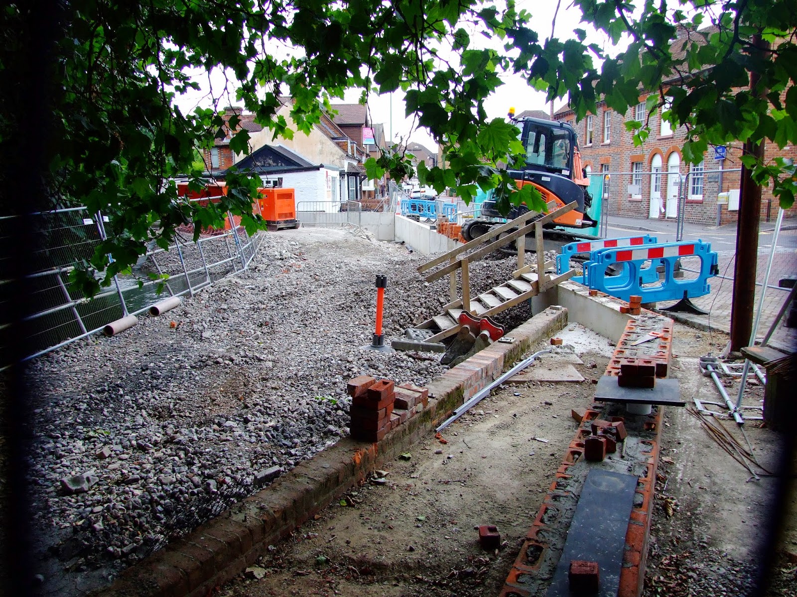
The access/portage point river left above the low-level pipe at the back of Island House and before Bewicks Reach cannot currently be accessed via Northcroft car park due to this area having been fenced of around a portacabin compound.

It will be interesting to see if improved access to the river has been provided once the compound is removed.

Paddling below this point would currently require exiting the river to the right almost immediately after the sluiced canal outflow by Dolton Mews as a barrage has been slung across the water course before the old slalom polls.

The new flood defence walls (and raised groundworks) at the back of Berwicks Reach are irrelevant to any thoughts of egress as these are private residence gardens.

The barrage before the old slalom polls (which now come with additional angling debris should you be thinking of playing here at a future date) on Northcroft Stream.

The barrage has been put in place to help protect the embankment enhancement wall currently being completed a little further downstream alongside Northcroft Lane between the Salvation Army Shop and the terrace of the Lock Stock & Barrel pub.  From the EA again: "We have installed a stone platform in the river near the Lock Stock and Barrel pub. This has been built to allow access for our machinery to construct a new river wall. The piled foundations for the wall are now complete and over the coming weeks we will be building the wall up to its full height."
 
The works platform has temporarily narrowed the Northcroft stream channel...
 
...but once the works have been completed the platform will be removed.
 
Any thoughts of slipping past the upstream barrage to shoot the remaining current channel might be tempered with the though of the further temporary bars to safe navigation. 

Tuesday, 9 July 2013

Chemical kill on the Kennet - UPDATE: Restrictions lifted


 9 July 2013 – DF/XXX/13


Restrictions on the Kennet lifted but Environment Agency investigation continues

The Environment Agency is still appealing to the public for information about where a pesticide that polluted the River Kennet between Marlborough and Hungerford last week came from.

Environment Agency officers have been investigating the source of the pollution, believed to be chlorpyrifos, a common agricultural pesticide, and have been taking samples to assess the impacts on the water quality.

Samples taken last week and over the weekend show that the pesticide has dissipated naturally with the water flow and levels have dropped significantly since last week.

Public Health England continues to work in partnership with the Environment Agency and Wiltshire and West Berkshire Council after a pesticide polluted the River Kennet between Marlborough and Hungerford.

Following the latest round of water sample results, Public Health England has advised that the previous restrictions asking the public and pets to avoid skin contact with the water can be removed. The Food Standards Agency has also advised that there should be no restrictions on eating fish caught in the river.

Paul Hudson from the Environment Agency said: “It is obviously great news that the pesticide has dissipated naturally and that the precautionary restrictions put in place have been removed following advice from Public Health England and the Food Standards Agency.

“We are still trying to trace the source of the pesticide, and we would appeal for anyone who has information to come forward so that we can take steps to educate those responsible and others to try to prevent it from happening again.

“We are also meeting with business owners along the Kennet regularly to keep them informed of the latest information.”

Environment Agency investigations have shown that many macro-invertebrates were killed last week, but there have been no reports of any fish killed.

Anyone with any information about this incident, or any pollution or environment incident, should contact us by calling our hotline number 0800 80 70 60.

Ends

Saturday, 6 July 2013

Chemical kill on the Kennet

The following warning has been issued with regard to the River Kennet:

"Environment Agency investigating pollution on the River Kennet

04-Jul-2013
 
The Environment Agency is appealing to the public for information about a pesticide that has polluted the River Kennet between Marlborough and Hungerford.
 
Environment Agency officers have been investigating the source of the pollution, believed to be chlorpyrifos, a common agricultural pesticide, and have been taking samples to assess the impacts on the water quality.

Investigations have shown that many macro-invertebrates have been killed, but there have been no reports of any fish killed.

Public Health England, working in partnership with the Environment Agency and Wiltshire and West Berkshire Councils, has advised the public to avoid skin contact with the water in the river until the exact concentrations and impacts of the pesticide have been determined. People are also being advised not to fish or to eat any fish caught in this stretch of the river at this time.

Paul Hudson from the Environment Agency said: “We have had officers out this week sampling the river as part of our investigation, and we will be back on site tomorrow and throughout the weekend to continue to monitor the impacts and any longer term issues.

“There are numerous locations and ways it could have entered the sewage treatment works before it reached the river, and we are appealing for any information anyone has about how this happened.“

“The levels in the river are not believed to be harmful, particularly as there has been no impact on fish in the river, but Public Health England has advised that people should avoid contact with the skin and keep their pets away from the water until further information is available.”

“Our main aim now is to investigate what has happened here, mitigate the impacts on the aquatic wildlife and take steps to educate those responsible and others to try to prevent it from happening again. We will also continue to keep river users along the Kennet informed as our investigation continues.”

“We are appealing to anyone with any information about this incident to get in contact with us by calling our hotline number 0800 80 70 60.”

Warning signs (often accompanied by a copy of the above statement) have been placed alongside numerous points of potential access to the upper reach of the River Kennet from Mildenhall...

...down to Eddington at Hungerford.

Friday, 5 July 2013

Barbel Bar wave shaping up for the sunshine

The small playable wave that forms below Barbel Bar weir was looking in nice form on the way home from work on Thursday evening.  Just right for some fun in the coming weekend sunshine...


Sunday, 5 May 2013

Make an old lady proud... go paddling on the River Kennet

River Kennet paddlers, 1643-2013.

1643 was not a good year for paddling on the River Kennet.  Especially if you were an old lady living in Newbury with an 'unnatural' ability to control your 'planck' on the flow of the then uncanalised waterway.

In his Parliamentarian propaganda pamphlet of that year, "A Most Certain, Strange, and true Discovery of a Witch" (which is subtitled "being taken by some of the Parliament forces as she was standing on a small planck board and sayling on it over the river of Newbury: together with the strange and true manner of her death, with the propheticall words and speeches she used at the same time."), John Hammond 'described' how foraging soldiers of the Earl of Essex dealt with someone who reportedly (good blog post on the pamphlet here) demonstrated an affinity with her local natural waterway environment, had the temerity to disregard the self-serving prejudices of the age, and laughed at self-proclaimed authority.  Having failed to overcome their ignorance, the soldiers adopted increasingly extreme responses, and eventually dispatched the woman by a bullet to the head, before justifying their actions with her posthumous vilification.

Leaping forward a mere 370 years to today, and it would appear that there are a small number of modern day 'Parliamentarians' and their camp followers for whom the act of canoeing and kayaking on the River Kennet is viewed as being as legitimate as witchcraft was in the 17th Century.

It's the "law of the land", the "law of the land", the "law of the land" I say... What do you mean by 'name the law'?  It's the "law of the land!"  Time for an "exemplary prosecution" methinks!

Former Reading West MP, Martin Salter, is now the Angling Trust's (AT) National Campaigns Co-ordinator, and the President of the Reading and District Angling Association.  His long standing position of objecting to inland waterway navigation rights is well attested, and he continues to use the unqualified phrase "the law of the land" to justify his opinion that "The rights of navigation are clear in law".  Whilst he has yet to answer the recent statement from the UK Government Department for Environment, Food and Rural Affairs (DEFRA) that "There is no clear case law on whether a 'common law right of navigation' exists on unregulated rivers. This is widely accepted to be an unclear and unresolved issue.", it is unlikely that such minor contradictions will impinge on his rhetoric.

In December 2012 Martin Salter wrote "I’m also sure we will be kept busy by the antics of the canoeists who will continue to flout the law until and unless we can secure a couple of exemplary prosecutions.".  When questioned in detail about this he failed to respond to a simple question:

Mr Justice Lightman has ruled that the: "Public Right of Navigation [PRON] may only be extinguished by legislation or exercise of statutory powers or by destruction of the subject matter of PRN eg through silting up of the watercourse."

A little over a month later, a succinct challenge to the claim by the Angling Trust on their Facebook page that "we prosecute [...] those who illegally paddle through sensitive spawning sites" could only be met with a similarly hollow threat:

Excerpted from an Angling Trust Facebook post thread dated 27.01.13.

Leaving aside consideration that such immature responses are hardly those befitting a NGB that styles itself "The Voice of Angling", these continuing assertions of opinions being 'facts' contribute little to forwarding a clarification of the issues around navigation rights, and in failing to dispel ignorance they can easily lead to further hardening of prejudices.

Step forward Mark Lloyd, Chief Executive at the Angling Trust.  This is the man who, despite ridicule of the AT's December 2012 assertion that "Organised trespasses are becoming all the more commonplace and are promoted through the 'independent' website 'Song of the Paddle' http://www.songofthepaddle.co.uk/ which promotes what they call 'open canoeing'.", repeated the phrase in demonstration of his complete ignorance of paddling two days later.

Does this help Mark?

In his response to George Monbiot's recent Guardian blog post referring to the River Kennet, Mark Lloyd once again repeated the standard AT line that "The law has been repeatedly confirmed by the courts and is absolutely clear: there is no universal right for people to canoe on non-tidal waters." whilst completely disregarding reminders of the clear statement to the contrary by DEFRA.  This is somewhat unsurprising in that, despite an open invitation dating from early 2011, the AT has also failed to make any cogent rebuttal of the works of the Rev'd Dr. Douglas Caffyn in support of a Public Right of Navigation (PRON):

Mark Lloyd's feeble and insulting response to the works of Douglas Caffyn (not to mention the University of Kent, the University of Sussex, and just about every other research student) consisted of "Both the BCU and Monbiot are causing confusion among the paddling public by promoting the work of one MSc student who wrote a thesis along these lines some years ago. Like many student theses, it has no foundation in truth or reality."  

When requested on the Guardian's online pages to simply identify the 'law' referred to, Mark Lloyd was unable to do so, despite supplying a number of largely irrelevant additional comments and citations of legal rulings which were comprehensively demolished. Ultimately he confirmed that he would "not be continuing this discussion", and by failing to either provide a substantive basis to his claims or move forward in a genuine effort to compromise, retreated to a position of continuing denial

This is a place that certain vested interests are happy to occupy in the belief that the clock can be stopped and a status quo maintained.  In response to the question "Will you rule out a statutory 'right to paddle' for canoeists?" Kennet riparian landowner Richard Benyon MP is reported to have said that "I want to be really clear about this. While we want more people to get out and enjoy activities in the countryside they must be complimentary [sic]. There are plenty of places to canoe where it is appropriate and others where it is not. There will be no change to our policy of supporting voluntary access agreements as the only way forward."

A reminder from 2007 when Richard Benyon was still keen to be seen to support his Newbury constituents' rights to use the Kennet Navigation.  His canvassing presence at the Crafty Craft Race on the weekend before the 2010 general election might now be considered to have been somewhat hypocritical.  On the 14 May 2010 Richard Benyon was appointed as Parliamentary Under Secretary of State at DEFRA with a portfolio that includes responsibility for inland waterways.  On the 18 June 2010 he resigned as a Vice President of the Kennet & Avon Canal Trust.  Whilst it might be said that this decision was taken to avoid a conflict of interest, his ministerial appointment has not stopped Richard Benyon and his family estate's continuing close association with the RDAA.

With regard to "voluntary access agreements" (VAAs), the concept of 'returning' to a system discredited by 50 years of failure holds little attraction to paddlers, and smacks of desperation on the part of land owners and fisheries who would still like to believe that "canoeing is only allowed with the permission of the people who hold property and fishing rights" (another Mark Lloyd comment from his Monbiot article response which completely fails to recognise that owning or purchasing fishing rights has absolutely no connection with inland navigation rights).  Either a PRON exists, in which case VAAs have no relevance (or validity as a government policy) other than for the potential to provide access to waterways and not control navigation along them, or it doesn't, in which case you might have expected to have seen regular prosecutions of paddlers.

For those ordinary anglers who would prefer not to share our waterways, comments such as those quoted by Messrs Slater, Lloyd and Benyon above are often taken to be accurate reflections of the law, may lead to further ill-informed repetition of unsubstantiated views on the PRON in England and Wales, and can even appear to provide 'justification' of the 21st century equivalent of 'loading the lead shot' as a solution.

The RDAA website members forum provides a clear example of this.  In June 2011 a thread was created where a member asked "Are canoes allowed on LB" ("LB" being the 'Lower Benyons', or the riverine loop of the Kennet at Sulhamstead). 

The first respondent expressed a belief on the subject, but sought clarification from the Association's officers: "as far as i was aware the stretch at lower benyons in considered non-navigable so canoes and boats should not be on it. if someone who knows more on this can confirm if i'm right in that belief it would be appreciated"

The RDAA General Secretary replied with the statement "Difficult to stop it as I am not sure if that backwater is deemed non - navigable."  However, the RDAA Fisheries Officer apparently believed differently, and stated "Lower Benyons from the weir downstream to where it rejoins the canalised section at Theale river is most defenatly [sic] NON-NAVIGABLE. That means no boats, dingies, rubber rings surf boards etc etc without the landowners permission."  .

This in turn led to a further member's comment that this was "Excellent info to know!", and that canoeists on this stretch would have the "rule book" thrown at them (without actually having been provided with anything more than opinion, let alone the relevant clause in the 'rule book').

When the question "Whats the ruleing [sic] on Canoe`s on the river kennet ?" arose again in September 2011, the original poster from above by then felt confident enough in the received message from the RDAA to write "They are not allowed there but i don't know what anyone can actually do short of a 3 oz zip lead, trebles and 50lb whiplash braid, should give a good battle in the current though if you do get 1 on".  The Fisheries Officer reinforced this opinion with the comment "Upper and Lower Benyons are private 'river' stretches", which in turn led to a member writing "Right then,Next time i`ll be taking my 30lb uptider stand up harness and my Conger Club.  :twisted:".

Such threats have been disavowed by the RDAA Chairman, and appear to have now ceased, at least in the public space of the RDAA forum, but it is easy to see how misinformation and ignorance can beget more of the same. 

The confusion of some RDAA members continued, and in July 2012 the question was once again asked in regard to paddling on the River Kennet: "it would be good to know rights of the situation regarding RDAA reaches of the Kennet and what to say when confronted with the situation."   Despite his previous forthright statements, the RDAA Fisheries Officer now felt only able to write "We are currently looking into our legal possition [sic] on this and as such we will not make any comments on a open forum.  We will however comment once our possition is clear."

With no answer from the RDAA having been publicly provided in the last 8 months, the position might now be considered best answered by referring to statute law (the real 'law of the land'); the 1715 Kennet Navigation Act states "It is also hereby further Enacted and declared by the Authority aforesaid that the said River Kennett is and forever hereafter shall be esteemed and taken to be Navigable"

If you don't fancy a trip down to the Public Records Office in Kew to see the original documents for yourself you might want to make do with the words of the Benyons' Estate Office as reported in the Monbiot article, where it says "Benyon leases his fishing on the Kennet to the Reading and District Angling Association (RDAA). Here, his office conceded, 'the entire stretch is fully navigable by water craft.' "

With this in mind, why not make an old lady proud, and spare her a thought as you enjoy your age old right to navigate the River Kennet.