Showing posts with label Lower reach guide - news 2011. Show all posts

Sunday, 20 November 2011

Kennet shutting down due to low later levels

Although the Kennet and Avon Canal is not normally the focus of this blog, it has a significant bearing on the Kennet Navigation and the riverine levels where it is a primary feeder source from just above Hamstead Lock.  With the closure of a long section of the K&A Canal last Thursday, it would seem likely that the lower reach of the River is now facing an indefinate extension or even exacerbation of the low water levels currently evidenced. 
The British Waterways announcement stated:

"Stoppage: NAVIGATION CLOSED UNTIL FURTHER NOTICE LOCK 61 TO LOCK 80

17 Nov 2011 until further notice

The canal has been closed to navigation between Crofton Lock 61 and Copse Lock 80 due to lack of adequate water supplies to support boat movement.

All of the locks within the closed section will be padlocked to prevent use. We are allowing levels in individual canal pounds to recover slowly. Several sections are very low and will take some time to come back to normal level. This is a long term problem brought about by ground water level being extremely low, in fact it is at the lowest level for 90 years.

The reservoir level is also very low and currently has little or no feed to recharge the system. The current stoppage is necessary to recover levels and help protect aquatic life in the canal.

British Waterways is currently looking to support the closed section with additional water supply from other sources.

The current closure is being reviewed weekly, and with little or no significant rain forecast the current closure may remain in force for some weeks."

The CEH October hydrological summary had already identified the critical lack or rainfall, exceptionally low river flow and almost record breaking low level of groundwater reserves on the 11th Novenber, so with the River Kennet failing in its own right, the news from the canal was most unwelcome.

The view at Benham Weir from the bottom of the fish pass on Sunday 13 November 2011.
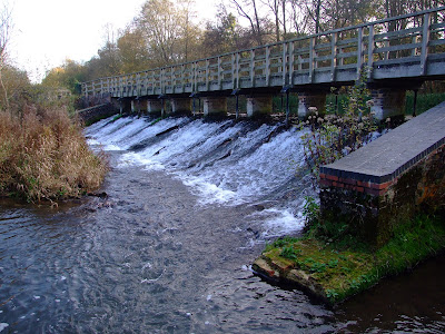
The footings of the weir buttresses would be covered for sufficient paddling levels, so whilst it would be possible to descend from the second space from the left as you approach the top of the weir...

...downstream paddling would probably be a scrape with the possibility of hitting spawning trout redds in current conditions.

Saturday, 17 September 2011

Low level riverine Kennet conditions persist

Having been out of the UK for most of August I was frequently told on my return how miserable the weather had been.  However, the CEH Hydrological summary for August states that

"in parts of southern Britain flows in index rivers were notably low and accumulated runoff totals over the last six months are depressed in most central and southern catchments. In rainfall terms, the drought has substantially decreased in spatial extent since the spring but with the bulk of the summer rainfall accounted for by evaporation losses, a wet autumn is required to generate a sustained seasonal recovery in the depressed runoff and, particularly, recharge rates across the drought-affected areas."

It continues that "Some southern spring-fed rivers have registered 16 successive months with below average flows and further evidence of the decline in baseflows is provided by the early cessation of flows in some winterbournes (e.g. the Till in Wiltshire)."

The River Kennet proves the point well, and Barbel Bar is currently showing even lower levels than when last reported in June.
The Environment Agency's Kennet gauging station at Barbel Bar is currently showing a river level of 0.23m. The typical river level range for this location is between 0.23m and 0.83m.

I've also been meaning to try out Aldershot Water as a route to access the river between Chamberhouse Mill and Brimpton Mill (rather than walking down through the nettles along the footpath alongside this short watercourse), but that doesn't look like happening any time soon.

Aldershot Water where it enters the River Kennet, connecting from the Kennet Navigation...

...but current levels are not for paddlers who like the bottom of their boats.

Sunday, 19 June 2011

River Kennet chosen to highlight contested paddling access rights

Some images from last weekend's paddle on the River Kennet between Padworth Lane road bridge and Sheffield Bottom.  Thanks to Jennie, Joel and Mal for the pics.

With paddlers travelling from Bristol, Hampshire, Surrey, and West Sussex, the chosen meeting point was the Kennet & Avon Canal Visitor Center at Aldermaston Wharf(pedantically, it should really be called the Kennet Navigation Visitor Center this far downstream from Newbury, but who cares).  There are 15 parking places, and on the sunny day before (when this picture was taken), they were full.  By midday on the 12th the wet forecast had allowed everyone to park up without obstructing other visitors, and having already enjoyed breakfast (my wife was bribed into assistance on the day with the promise of a bacon and egg butty, which I wished I'd ordered too as I watched her enjoyment over my toast and coffee), the group moved down to the put-in.

With 8 vehicles turning up at the put in (including our volunteer shuttle driver who'd only learnt the route the day before), off-roadside parking for 2-3 vehicles can be made just before the bridge, whilst just over the bridge there is similar space for 4-5 vehicles considerately parked. A thank you goes to the landowner  who responded kindly to our request to park next to his gate.  The group gathered for a final briefing alongside the public footpath that runs river left between Padworth Mill and Padworth Lane.

The put in utilised an existing track and break in the plant growth for minimal disturbance.
The group of 11 paddlers (including one two year old - canoeing and kayaking is an inclusive, family orientated activity for all ages) assembled on the water...

...before the 6 canoes and 2 kayaks headed towards Padworth Lane road bridge.

Once beyond the bridge the group were now paddling through the Englefield Estate, home to DEFRA Waterways Minister Richard Benyon.  He had been contacted prior to the paddle for advice on any potential hazards or river works, and the communication had been forwarded to the Estate Office, who advised that there were no known obstructions on the route.

The section down from Padworth Lane is a prime fishing beat, and other than a half-submerged old rowing boat, is remarkably free of the litter and other human debris that so often blights such stretches of the Kennet.

Some of the wider sections currently display gravel shallows at their margins, but the main river channel is more than deep enough to provide easy passage without scraping or touching the bottom.

One end of the old partially collapsed bridge built by POWs in WW2, was recently removed by the Estate as it was causing a tree-gathering obstruction.

Once past the old bridge Ufton road bridge was quickly reached...

...and the group paddled towards the confluence with the Navigation and an uncontested right of navigation.

The first portage was at Tyle Mill Lock.

This was quickly followed by the second and final portage to negotiate Sulhamstead Weir.  A public footpath runs over the top of the bridge atop the weir...

...and then river left along the bank for about half way around this riverine section which is once again bordered to the north by Englefield Estate lands.  Such is the popularity of this stretch of river with RDAA members that the numerous breaks in the foliage are  permanently established and provide for easy re-entry to the waterway.

About half way round the section a tree-fall spanned the river, but it was carefully negotiated in single file.  The slow flow of the river made this easily possible, but such obstructions might prove dangerous at higher water levels.  The Estate was advised of the obstruction immediately after the paddle, for which thanks were expressed.

The rain had been intermittent and fairly light but now set in...

...as we returned to the Navigation and headed toward Bonsal's Point.  A lady on a narrowboat enthusiastically greeted the group with thumbs up as it passed as she had heard BBC Radio Berkshire's news bulletins reporting the purpose of the paddle to promote public navigation rights.

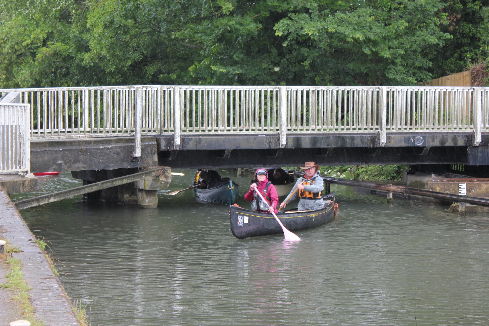
Canoeists and kayakers can duck under the swing bridge at Sheffield Bottom...

...before reaching the take out above Sheffield Lock which is conveniently adjacent to the large public car park.

Many thanks to those who travelled some considerable distances to highlight the disputed right to paddle on the inland waterways of England and Wales.  Their effort is not diminished by the disappointing (if predictable) response of DEFRA spokesman Richard Benyon the following day (more on this later), and demonstrates that the Government's anachronistic and partisan promotion of so called access 'agreements' is neither accepted or necessary for the public to responsibly enjoy their natural heritage rights.

Friday, 3 June 2011

Another River Kennet hazard removed above Barbel Bar weir

At the behest of the Environment Agency, an old cattle feeder that had been sitting in the River Kennet above the weir at Barbel Bar for over a year has been removed by the Caversham-based Royal Berkshire Fire and Rescue Service Water Rescue Unit.

 
Low water levels made it an easy task to cross the river, which is currently only just chest deep in the center of the channel.

The cattle feeder cage is removed to the bank river right by the RBFRS WRU...

...who then demonstrated just how low the water level is by walking back up the weir face.  When the weir at Barbel Bar is at this level...

...it equates to an Environment Agency river level reading like this.

Sunday, 15 May 2011

Lower Kennet paddling obstruction removed

The obstruction that used  used to greet paddlers at SU 617 684 is no more.  The partially collapsed bridge that formerly provided access to the West Meadow island was a magnet for tree debris on the section of the riverine Kennet shortly before it rejoins the Navigation after Ufton Road bridge.

Approaching the bridge in summer 2009.  The size of the blockage is attested to by the amount of green growth.

When viewed from downstream the cause of the blockage was more apparent and the squeeze through river left is just visible.

Even die-back and winter flows  failed to dislodge the blockage, leaving a potentially nasty hazard to navigation.

Riparian landowners have an obligation to ensure river blockages are removed, and in this instance it must have been no little effort to take out the collapsed bridge section. 

There are now no structural bars to navigation by canoe and kayak along the 2.9 km (1.8 mile) run from below Padworth Mill to Ufton...

...although branches in the river are still frequent and occasional larger tree falls persist.

Saturday, 14 May 2011

River Kennet paddling hit by the weather... and bankers

In part a continuation of my post on 21.03.10, two 'events' are looking likely to have a serious impact on the health and paddling potential of the riverine Kennet in the coming months.

The first 'event' is the weather, and the reported fact that "April was a very remarkable month in hydrometeorological terms: provisionally it was the warmest April in the 352-year Central England Temperature series, estimated (river) outflows from Britain were the lowest on record for the last week of April, and the end-of-month soil moisture deficits were the highest (for England & Wales) in a 50-year series." [1]

An employee of the Centre for Ecology & Hydrology has further stated that “Historical rainfall figures indicate a tendency for dry spring periods to be followed by above average summer rainfall, but with evaporation rates increasing even average summer rainfall would imply very low late summer river flows – and an associated major contraction in the river network.” [2]

The non-canalised sections of the lower reach of the River Kennet are already beginning to show signs that increased levels of consideration need to be made when planning to paddle off the beaten track of the Navigation, both in terms of environmental conditions and resultant requirements for alternative access.

A couple of strolls around the vicinity of the Old Mill at Aldermaston yesterday evening and this afternoon illustrated some of the issues for paddlers.

The portage around the small but un-runnable weir fed by the canalised flow above the main property - and which avoids the main channel by means of a side stream (supported by the confluence with the River Enborne) - is still entirely viable.  Potential concern about the current thin reed line may be tempered by consideration of what will happen after the fishing season opens (see image from Oct. '09 in link above).

However, whilst the weir pool is deep enough...

...just downstream the water levels are looking rather low.  Whilst this might be beneficial in terms of getting under the low hanging tree branch at the River Enborne confluence, the water level might present issues of potential contact with the river bed. Consideration should always be given to areas of clean gravel bed with fast flowing water where Barbel may have recently spawned (normally between May and July): "The young Barbel hatch within a week , but unlike other coarse fish the young remain in the gravel for several weeks, surviving first off their large yolk sack, and then actively hunting tiny invertebrates in the spaces amongst the gravel." [3]

In seeking to portage this low level section it would be possible to follow the side stream after the River Enborne confluence by the public footpath to the point where it reaches the lower edge of the Old Mill at Aldermaston fishery, and the confluence with the main channel below the sluiced weir.

Alternatively, you might haul your boats a little further along the public footpath, carefully cross the B430 Basingstoke Road, and put in to the river below the road bridge just off the public footpath... 

...except for the fact you would now be on Wasing Estate land that continues to warn against accessing the river from its property.  More about this estate and its owner in a coming post.

The second 'event' that will have a significantly negative impact on the whole of the River Kennet is the Environment Agency's renewal of Thames Water's Axford abstraction licence until March 2013.  Reported online in Newbury Today, the current position would appear to be that the EA is being held over a legal barrel until it saves up/coughs up £10m. 

Taken to its logical, absurd and disgusting conclusion, this situation is likely to be repeated until either the aquifer is unable to  respond to the abstraction requirement (by which time the upper River Kennet will have ceased to exist) or Thames Water persuades its owners in Australia, Macquarie Group Limited, that its admirable efforts in leading the Upper Kennet Restoration Project should be considered as more than a token gesture.


[1] Source: http://www.ceh.ac.uk/news/news_archive/april-hydrological-summary_2011_28.html
[2] Source: ibid.
[3] Source: http://www.fishing.co.uk/species_display.php3?id=1

Saturday, 16 April 2011

River Kennet loop at Chamberhouse Farm, Thatcham

The approximately 3km (1.8 mile) riverine section of the River Kennet at Chamberhouse Farm, near Thatcham, is an ideal introduction to moving water, and is currently running with sufficient depth that, with a little care, you can easily avoid scrapping along its several gravel bars and banks, and is clear enough of overhanging trees to provide an uninterrupted run. 

Details of how to access this section from the canalised river can be found in the original guide post, and once you get there there's not much that has changed since 2008/2009. 

Exiting the canalised River Kennet river right just before Widmead lock, a small weir marks the start of this section (at SU 505 662).  Keep river left to avoid the trees to the right and the large gravel bank in the centre of the river below the weir.

There is no public access to the banks along this part of the river (although there is a path for anglers river right), but there are plenty of eddies to sit in in the wider winding first third of this run...

...if they're not full of detritus from the canal and vandalised footpath signs.

This section of the Kennet is ideal for easy touring and introductory paddling.  This Dagger Approach is a hybrid river running and touring kayak (from Berkshire Canoes in this instance) and is well suited to the River Kennet.

The Pyranha Fusion is an alternative hybrid crossover style kayak.

Where the river widens the gravel shallows can be easily avoided along main channel routes.  Although there is no evidence that canoeing and kayaking harms fish, this part of the river may later be used as a spawning ground by fish such as barbel (probably a bit too far downstream for most trout), which migrate upstream, and lay their eggs between May and July (see here).

Friday, 21 January 2011

Kayaking is not a crime, but...

Thames Valley Police has reported the suspected involvement of a recovered kayak in a number of burglaries near the River Kennet in Reading:

"Thames Valley Police is trying to trace the owner of a kayak that has been found abandoned on the River Kennet in Reading.

The boat was found by a member of the public yesterday (20/1).

Police believe that the boat may be stolen and that it may have been used to transport goods stolen in recent burglaries in the Waterloo Meadows area.

PC Jon Hare, from the Burglary Team at Reading police station, said: “I am keen to hear from anyone who thinks that this kayak belongs to them.

“I am also keen to hear from anyone who has seen a kayak being used in suspicious circumstances on the Kennet recently.”

Anyone with any information about this boat should contact PC Hare via 0845 8 505 505.

Alternatively, if you do not want to speak to police, or leave your name, please contact the Crimestoppers charity on 0800 555 111."

The River Kennet is fully canalised where it runs alongside Waterloo Meadows and on past the back gardens of Elgar Road houses.  Despite its proximity to the A33, this is normally a very peacefully stretch of the waterway after travelling down from Fobney Island and before reaching County Weir.  There aren't too many inner city paddles where you can pass by places like this, which might explain the popularity of canoeing and kayaking with local residents.

Just downstream of Waterloo Meadows, locals recognise the River Kennet as a great location for easy canoe and kayak paddling.