Saturday, 2 February 2013

Navigation rights on the Kennet & Avon Canal...

...are not controlled by the Reading and District Anglers Association (RDAA).  But sadly, nobody seems to have told them!

Whilst this blog is not primarily focused on the Kennet and Avon Canal (other than the short sections where it interacts with the River Kennet above the start of the Kennet Navigation in Newbury), and although I'm not especially interested in competitive flat water racing, the monthly online RDAA Information Sheet, which includes the General Secretary's omniscient February Report, was published today, and it contains a short passage which provides a vivid insight into the thinking of some of the river users.

"CANOE RACE

The RDAA match scheduled for Sunday February 3rd will have to be moved due to around 400 to 600 canoes being scheduled to go through the Froxfield stretch on the same Sunday. This was not passed on to us and I only found out from the Thatcham Angling Shop. I have spoken with the Canoe Clubs involved and insisted that they leave the first Sunday in the first three months of the year free for our matches. It would appear that there are more and more of these events appearing especially at this time of the year. It was agreed to reschedule the match to Sunday February 24th in place of the Teams of Four match which will be rescheduled to a date in April.”

1. "400 to 600 canoes"?  That should have the organisers, Newbury Canoe Club, worried, as, if I've counted correctly, the list of pre-entered participating crews (no entries on the day for this particular race) numbers 303 canoes and kayaks of various classes.  Hopefully the number will be higher next year, as, with competitors and their support crews arriving from as far afield as Fowey and Exeter, Worcester, Nottingham and Norwich, it brings valuable income to the local economy at a lean time of the year.

2. "This was not passed on to us and I only found out from the Thatcham Angling Shop."  Perhaps greater willingness to build communications and understanding with other waterways users might help to resolve this - there's not that many canoe clubs running larger scale races on the Kennet.  There is no obligation to advise RDAA or any other angling clubs of race events, although they could just look at the Waterside Series website, where the dates of future races (and we're only talking about four events per annum) are published more than a year in advance.  The Waterside series has been run (with a cancellation in 2001, and occasional date changes due to weather conditions) during approximately the same period of the year since 1999, so it should hardly be a surprise by now.

3. "I have spoken with the Canoe Clubs involved and insisted that they leave the first Sunday in the first three months of the year free for our matches."  The General Secretary was lucky that Newbury Canoe Club was able to confirm future dates that suit all parties - see 2014 Waterside Race dates below.  Perhaps 'requested' or 'negotiated' might have been a more productive approach than "insisted", because the RDAA is not a navigation authority and has absolutely no right to dictate to other river users.  The Canal & River Trust is the legal Navigation Authority for the Kennet & Avon Canal above Newbury Bridge, and also for the Kennet Navigation from Newbury Bridge to a point 65m downstream of the High Bridge at Reading.
 
4. "It would appear that there are more and more of these events appearing especially at this time of year."  Apart from the predictable Waterside Series, there's Reading Canoe Club's Thameside 1 race from Aldermaston Wharf down the canalised Navigation to Reading on the 10th February this year (about 60 crews currently registered to participate), and then there's the...  oh, that's it (as far as I know).  Perhaps the General Secretary has confused recreational canoeists and kayakers on the Kennet with some sort of poorly attended 'slow boat' race event.  It would be an understandable mistake given that the RDAA President, Martin Salter, works for the Angling Trust; they recently equated "open canoeing" with some sort of semi-underground campaign of civil disobedience.
 
A few dates and details for future reference:
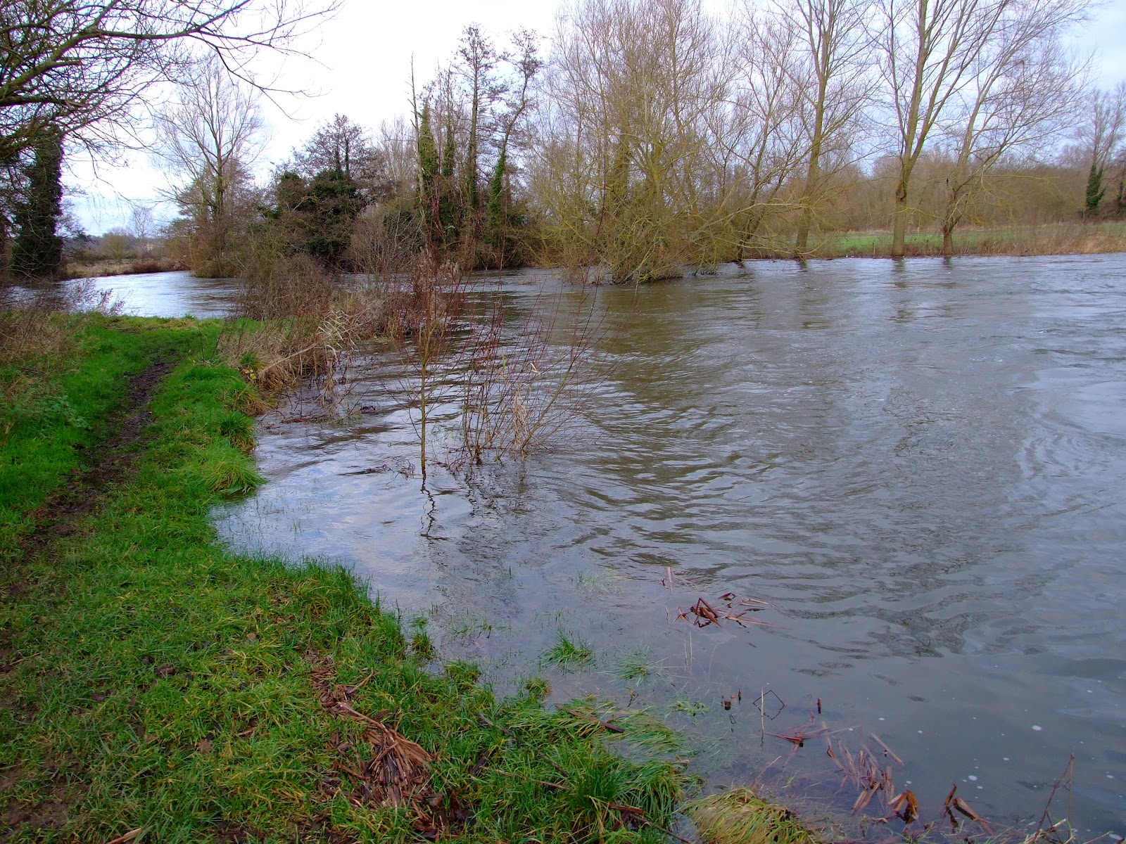
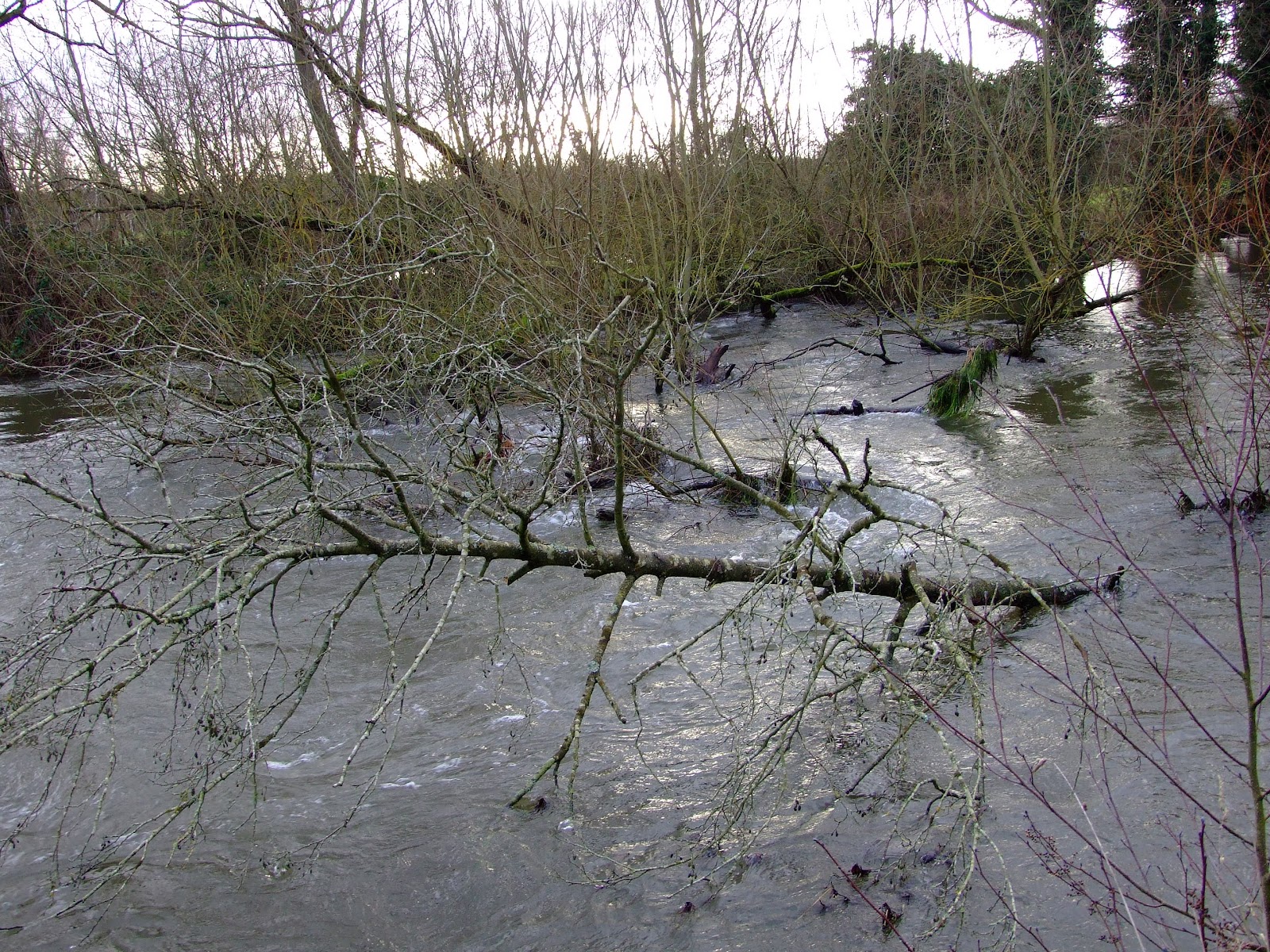
  • Race A will take place tomorrow between Great Bedwyn and Newbury.  The course is 13½ miles and includes 21 portages.
  • Race B: 17 February - Newbury to Aldermaston & back (17.5 miles incl. 19 portages).
  • Race C: 3 March - Pewsey to Newbury (23 miles incl. 35 portages).
  • Race D: 17 March - Devizes to Newbury (34 miles incl. 35 portages).
The Waterside Series Races for 2014 are scheduled to take place as follows:
  • Race A: 23 February 2014.
  • Race B: 9 March 2014.
  • Race C: 23 March 2014.
  • Race D: 6 April 2014. 
The Waterside Series is regarded as a “warm-up” for the 125 mile Devizes to London International Canoe Race, which, as in previous years, takes place over the Friday, Saturday and Sunday of the Easter weekend in 2013.
 
It won't bother anglers who will be enjoying the closed season rest...  hang on, haven't I used that line before somewhere?

Tuesday, 22 January 2013

River Kennet Winter Wonderland

No tags or comments, just a selection of photo's from the upper and middle River Kennet running downstream from West Kennett to Hamstead Mill on Sunday.


Tuesday, 15 January 2013

Paddling past the Fobney Island (very) Wetland Nature Reserve

With the River Kennet uncharacteristically maintaining above average levels, there are a few places where some of the normal restrictions on paddling have been temporarily suspended, providing a brief window of opportunity to experience a small change of tempo from the comparatively predictable experience of the Navigation's cut sections.

The Fobney Island Wetland Nature Reserve still has some way to go before it fulfils its potential as an easily accessible conservation and wildlife haven just minutes from the center of Reading, but it's already demonstrating its ability to respond as a repository of  increasingly unpredictable rain fall and river flow rates.

The temporary map at the eastern entrance to the reserve indicates the expectation that the reserve will normally maintain refuge level pools to benefit a range of fauna and flora.  Not a great photo, so the text reads as follows:

"In 2011 the Environment Agency, Reading Borough Council, Thames Water and the Thames Rivers Trust worked in partnership to improve Fobney Island for wildlife and for nature-based recreation.  The Berkshire Ornithological Club and the Reading and District Angling Association provided specialist advice throughout the project.  Previously the site was ecologically poor rough grassland.  Now, it is a mosaic of wetland, wildflower meadow, hay meadow and reed bed habitats.

The first phase of the project lowered the land to create wetland features that, at certain times of the year, will be in connection with the River Kennet to the south of the island.  This has improved the site for birds, bats, fish, reptiles and amphibians.

During spring 2012 scrub planting and grass and wildflower seeding was done to further improve the site for wildlife.

The site is divided roughly into two sections.  The Eastern Wetland features (closest to Fobney Lock) were designed to be in connection with the groundwater and should remain 'wetted' for most of the year.  In contrast, the Western wetland scrapes (towards the pylon) were formed to be in connection with the river in periods of high flow but then slowly to drain down during the spring and summer.  These scrapes are expected to be temporary or 'ephemeral' features because they are reliant on surface water.  When the river is in flood, they provide a vital temporary refuge for fish.

The river has also been restored to a more natural state through the introduction of two new riffle features - areas of shallow gravel that provide ideal spawning grounds for fish such as chub, dace and barbel. 

On the south bank of the river, lifting and thinning the crowns of the trees has let more light into the river channel.  This helps plant species to become established.  Five trees have been dropped into the river channel to create 'woody debris' features which create more diverse flows within the river.

A new footpath has also been installed to create easy public access to the Eastern Wetland site, and two bird hides provide views across the new wetland features.  There is no public access to most of the Western Wetland, to ensure undisturbed protection of wildlife.

DOG WALKERS are welcome anywhere on the Eastern Wetland, but are asked not to allow dogs to cross into the Western Wetland at any time.  A dog bin is provided at the entrance near Fobney Lock.

PLEASE KEEP THE SITE CLEAR OF ALL LITTER, which can be very harmful to wildlife. 

THE FRIENDS OF FOBNEY ISLAND is a group of volunteers who help to maintain, monitor and consult on the use of this site.  If you are interested in joining the Friends group, or helping with volunteer tasks, please call reading Borough Council's Parks Department on 0800 626540.  Please use the same number to report incidents."

Although it's not explicitly stated, there are several pieces of information contained in the above sign text which will help you judge whether to paddle down this section, but the two key factors are water levels and the time of year.  A few pictures + a little knowledge should help with the decision.

The remodelling of Fobney Island didn't include a canoe pass past the sawtooth weir but, as you portage past, the volume of water flowing over and the remaining height down to the new river level gives a good indication of whether it's good to go.

Comparative low flow (from June 2010) and high flow (from January 2013) at Fobney Weir's saw teeth.

Comparative low flow (from November 2011) and high flow (from January 2013) looking back up to Fobney Weir from the right bank put-in.

Comparative low level (from June 2010) and high level (from January 2013) bank heights at the put-in river right below Fobney Weir.

Comparative low levels (from June 2010) and high levels (from January 2013) of the River Kennet viewed from the footbridge at Fobney Weir.

Comparative low levels (from June 2010) and high levels (from January 2013) of the River Kennet viewed looking downstream of Fobney Weir pool, left bank above the top of the Western Wetland.

The above images should provide a fairly easy indication of whether there's sufficient water to paddle without scraping the bottom, particularly now that the riverine section below the weir pool the river has been remodelled with "two new riffle features - areas of shallow gravel that provide ideal spawning grounds for fish such as chub, dace and barbel." 

Dace will start spawning from early March in cold, shallow water when they congregate over gravel that is just sufficiently under water to cover them.  Once their eggs are fertilised they take about three weeks to hatch because of the lower water temperature.  Chub are similar in their spawning behaviour to Dace, but they don't get it on until somewhere between the start of May and mid-June, so their eggs only take about 3 days to hatch in the warmer water.  Barbel don't tend to spawn until between May till July.  However, whilst the eggs hatch within a week, the young Barbel continue living within the gravel for several weeks. 

What this essentially means for paddlers is that if there's not sufficient clearance with the river bed between March and August, the canalised cut is the best bypass route downstream.  This might seem frustrating when the riverine route is free of anglers between the mid-March and mid-June closed coarse fishing season, but the upside is that if there is sufficient water to make the run without environmental harm there's a good chance that it will have driven the fishing folk onto the canal. 

At times when both paddlers and anglers can use the river together, note that most fishing just below the weir will be from the left bank - even at intermediate levels the pool should be wide enough to avoid entanglement with lines - whilst once onto the narrower river section anglers now fish from the right bank and may be hidden by the trees.  If you spot a line or camo clothing at such times, normal river etiquette applies.

Once onto the river channel, beware the "five trees [that] have been dropped into the river channel to create 'woody debris' features which create more diverse flows within the river", and keep in mind that during high flows additional hazardous debris may have washed down and the number of tree 'falls' may have increased.  Keeping river left should help with safer navigation.

A potential strainer shown at high water levels on the River Kennet south of Fobney Island.

A couple of final pictures serve to demonstrate what high water levels at Fobney Island currently look like.

The view looking upstream, and west towards the flooded Western Wetland, from the unsurfaced public footpath by the riverine section of the Kennet on the Eastern Wetland section.  The river runs alongside the tree line; the ingress of water into the flooded relief pools should not be paddled. Does that pylon have a problem?

The gauge below Fobney Lock reflects what's coming down the canal cut and the riverine course.  Note that the disappearance of the mooring platform by the old pumping station is a good sign that paddling levels are good. 

Saturday, 12 January 2013

New year high levels for the River Kennet Navigation Newbury to Thatcham

Whether using the Kennet Navigation as the means of a circular route around, or simply as access to the Chamberhouse loop, the canalised and riverine run down the Kennet between Newbury and Thatcham has started 2013 at an unusually high level. 

The convergence of the river section that flows down from Hambridge to join the cut at Bull's Lock normally demonstrates reasonably consistent levels, but the current height of the water may create a few unexpected minor changes of plan for paddlers.

Typical gauge readings at the tow path footbridge below Bull's Lock...

...are not matched by current conditions.  The river is approximately .5m higher than normal.

If you were to put in on the section of the river upstream of the footbridge (which appears to have had many of the former tree falls cleared recently, should you be paddling down from Hambridge)...

...you would quickly be faced with limboing under the bridge in the relatively fast flowing water (viewed here from downstream of the bridge on the flooded far bank of the lock exit).

It's probably therefore currently easier to just put in directly after the bridge and below the lock.

The current flow rates will enable a quick journey down to the weir marking the start of the Chamberhouse loop (river right just before Widmead Lock), but please be aware that this riverine section is currently substantially higher and broader than might normally be anticipated.

The Chamberhouse loop has flowed out of its banks around the footbridge at SU 511 657.  The bridge, which appears to have suffered damage from a tree-strike, is passable river right.

The drainage channels that run to the north of the loop (river left) have also inundated swathes of surrounding land and merged with the river (in the foreground at the bottom of the southern Kennet Valley escarpment) before reaching Chamberhouse Farm.

The river is just about back in its banks by the time it reaches the bridge at Chamberhouse Farm, viewed here looking upstream...

...and downstream.

The return channel from the river to the canal cut near Thatcham station from below Monkey Marsh Lock.

For anyone wishing to return upstream to Newbury/make a circular route by use of the canal cut, portaging at Monkey Marsh Lock, Monkey Marsh bridge (not enough room to get under it) and Widmead Lock is currently very easy as the Navigation is also extremely high.

Friday, 28 December 2012

Water levels up and down the Kennet Valley

With 2012 drawing to a close, and the national media full of articles and images reporting flooding around the country or warning of worse to come, the Kennet Valley has continued to produce high river flow rates and the River Kennet has over-spilled it's banks at a number of locations.

The upper reaches of the River Kennet

It's not often that the upper reach of River Kennet provides sufficient levels for paddling, but access to the water and around obstacles in the water course limit its potential.

The view from West Overton Bridge on Boxing Day was almost identical to that recorded a month ago at this location.

Downstream at Marlborough, the weir below Pewsey Road Bridge is the site of the EA gauging station.  Although levels were falling when this photo was taken after a Christmas Day high of 0.48m (the typical river level range for this location is between 0.04m and 0.37metres), at the time of writing today the river was still sitting at 0.43m.

From the northern slope of the Kennet Valley between Stitchcombe and Axford, where the River Kennet was out of its banks on the 26th December.

The river was already lapping over the fisherman's footpath downstream from Ramsbury bridge on Christmas Eve, whilst the extensive flooding of downstream fields from Knighton could be easily seen from the B4192.  The Knighton main river gauge is currently reading 0.61m (the more usual river level range for this location is between 0.08m and 0.43m).

At the broad bridge at Lackbridge Cottage below Littlecote the gauge marker was running out of numbers on the 26th.

The middle reaches of River Kennet

With limited access to the River Kennet along much of the middle reach inhibiting paddling, the riverine loop from Benham Weir provides the potential to detour away from the Kennet & Avon Canal all the way down to Newbury.

The left hand sluice by the old WW2 defence emplacement (be careful if walking here as the concrete base is being undercut and is gradually collapsing) is open for business...

...which has noticeably raised the river pool level, making an easy descent down the shortened main weir face...

...before proceeding downstream.  Note the sluice outflow cuts across the river and recirculates against the left bank before flowing away.

The river level was raised to the extent that it was overlapping the bank opposite the weir, and was sufficiently high on Boxing Day to submerge the end of the fish ladder and hide the steel bar that is located between the concrete arms at the bottom of the ladder.

For more images of what might be expected downstream from Benham Weir see the description from halfway down the post titled "The middle reach of River Kennet", but note that this was written in late 2009 (ignore the December 2008 date) and that river conditions may have changed.

It's also worth noting that with many flooded areas on the approach to Marsh Benham it's worth taking extra care on the roads.

 Milkhouse Lane, travelling back to the A4 from the Marsh Benham put-in.

The lower reaches of the River Kennet

Newbury's Victoria Sluices have been opened to help maintain the Navigation cut levels.

The Padworth to Ufton run has been demonstrating high flow rates and high water levels.  All of the following images were taken yesterday.

The gauge at Padworth Bridge showed the increase over the already high levels from 11 days previously.

Upstream from the bridge towards Padworth Mill on the public footpath, the river level has breached the bank top.

The view downstream from the put-in just above the bridge on the left bank.  It's still possible to pass under the bridge but watch your head.

Once beyond Padworth Bridge it's just a question of keeping to the river course, avoiding trees...

...and other well hidden hazards.

The River Kennet at bank full levels and beyond at Padworth.  These conditions continue down to Ufton bridge.

Once at Ufton the current water level may require portaging around the road bridge (unless you have a squirt boat perhaps), which, looking back upstream, begs the question how this tree debris got underneath.

Still further downstream at the Sulhamstead loop, there are also some interesting conditions.

Sulhamstead Weir hiding its collection of potentially lethal anti-scour rocks with fast flowing water...

...which has raised the level of this section to the height of the bank by the public footpath river left below the weir for an easy put-in.

The usual tree-fall hazards are avoidable with care.

Draper's Osier Bed Stream has enough water to go without scraping the bed at present, but mind your head and be aware of the upright angle iron embedded right in the centre of the middle channel.

Once below the weir a new willow tree-fall hazard from the right bank should be passable to the left, but watch out for other trees and branches as there is little room for manoeuvre once beyond the weir pool.

There's also an old footbridge framework not long before you reach Station Road bridge (unless it's been removed - this image is from 2009)...

...and with the water at this height - here shown looking upstream from the Station Road bridge - passage under the bridge itself might be blocked. 

Once back to the Kennet above Barbel Bar, be aware that the water flowing down from Shenfield Mill is at a very high level; note the submerged decking in this image.

Once through to Barbel Bar, you'll probably find that a reasonable playwave has returned.  Although almost washed out yesterday, the EA gauge shows that levels are now dropping.