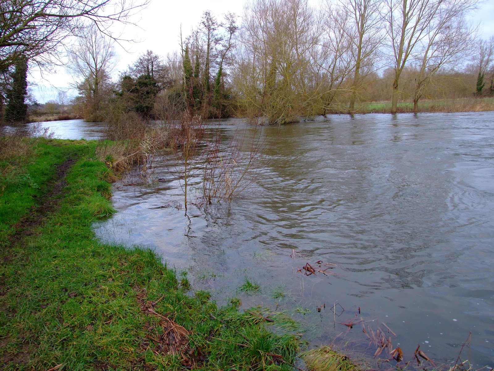
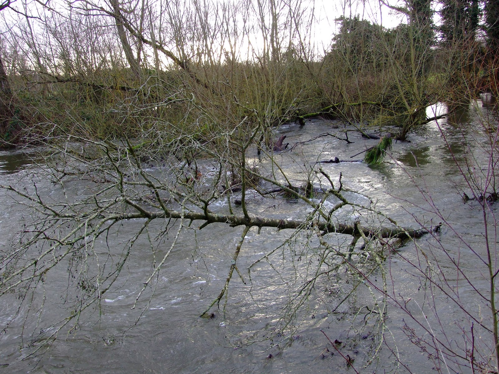
With 2012 drawing to a close, and the national media full of articles and images reporting flooding around the country or warning of worse to come, the Kennet Valley has continued to produce high river flow rates and the River Kennet has over-spilled it's banks at a number of locations.
The upper reaches of the River Kennet
It's not often that the upper reach of River Kennet provides sufficient levels for paddling, but access to the water and around obstacles in the water course limit its potential.
 The view from West Overton Bridge on Boxing Day was almost identical to that recorded a month ago at this location.
 Downstream at Marlborough, the weir below Pewsey Road Bridge is the site of the EA gauging station. Although levels were falling when this photo was taken after a Christmas Day high of 0.48m (the typical river level range for this location is between 0.04m and 0.37metres), at the time of writing today the river was still sitting at 0.43m.
 From the northern slope of the Kennet Valley between Stitchcombe and Axford, where the River Kennet was out of its banks on the 26th December.
The river was already lapping over the fisherman's footpath downstream from Ramsbury bridge on Christmas Eve, whilst the extensive flooding of downstream fields from Knighton could be easily seen from the B4192. The Knighton main river gauge is currently reading 0.61m (the more usual river level range for this location is between 0.08m and 0.43m).
 At the broad bridge at Lackbridge Cottage below Littlecote the gauge marker was running out of numbers on the 26th.
The middle reaches of River Kennet
With limited access to the River Kennet along much of the middle reach inhibiting paddling, the riverine loop from Benham Weir provides the potential to detour away from the Kennet & Avon Canal all the way down to Newbury.
 The left hand sluice by the old WW2 defence emplacement (be careful if walking here as the concrete base is being undercut and is gradually collapsing) is open for business...
 ...which has noticeably raised the river pool level, making an easy descent down the shortened main weir face...
 ...before proceeding downstream. Note the sluice outflow cuts across the river and recirculates against the left bank before flowing away.
 The river level was raised to the extent that it was overlapping the bank opposite the weir, and was sufficiently high on Boxing Day to submerge the end of the fish ladder and hide the steel bar that is located between the concrete arms at the bottom of the ladder.
For more images of what might be expected downstream from Benham Weir see the description from halfway down the post titled "The middle reach of River Kennet", but note that this was written in late 2009 (ignore the December 2008 date) and that river conditions may have changed.
It's also worth noting that with many flooded areas on the approach to Marsh Benham it's worth taking extra care on the roads.
 Milkhouse Lane, travelling back to the A4 from the Marsh Benham put-in.
The lower reaches of the River Kennet
 Newbury's Victoria Sluices have been opened to help maintain the Navigation cut levels.
The Padworth to Ufton run has been demonstrating high flow rates and high water levels. All of the following images were taken yesterday.
 The gauge at Padworth Bridge showed the increase over the already high levels from 11 days previously.
 Upstream from the bridge towards Padworth Mill on the public footpath, the river level has breached the bank top.
 The view downstream from the put-in just above the bridge on the left bank. It's still possible to pass under the bridge but watch your head.
 Once beyond Padworth Bridge it's just a question of keeping to the river course, avoiding trees...
 ...and other well hidden hazards.
 The River Kennet at bank full levels and beyond at Padworth. These conditions continue down to Ufton bridge.
 Once at Ufton the current water level may require portaging around the road bridge (unless you have a squirt boat perhaps), which, looking back upstream, begs the question how this tree debris got underneath.
Still further downstream at the Sulhamstead loop, there are also some interesting conditions.
 Sulhamstead Weir hiding its collection of potentially lethal anti-scour rocks with fast flowing water...
 ...which has raised the level of this section to the height of the bank by the public footpath river left below the weir for an easy put-in.
 The usual tree-fall hazards are avoidable with care.
 Draper's Osier Bed Stream has enough water to go without scraping the bed at present, but mind your head and be aware of the upright angle iron embedded right in the centre of the middle channel.
 Once below the weir a new willow tree-fall hazard from the right bank should be passable to the left, but watch out for other trees and branches as there is little room for manoeuvre once beyond the weir pool.
 There's also an old footbridge framework not long before you reach Station Road bridge (unless it's been removed - this image is from 2009)...
 ...and with the water at this height - here shown looking upstream from the Station Road bridge - passage under the bridge itself might be blocked.
 Once back to the Kennet above Barbel Bar, be aware that the water flowing down from Shenfield Mill is at a very high level; note the submerged decking in this image.
 Once through to Barbel Bar, you'll probably find that a reasonable playwave has returned. Although almost washed out yesterday, the EA gauge shows that levels are now dropping.
The upper reaches of the River Kennet
It's not often that the upper reach of River Kennet provides sufficient levels for paddling, but access to the water and around obstacles in the water course limit its potential.


The river was already lapping over the fisherman's footpath downstream from Ramsbury bridge on Christmas Eve, whilst the extensive flooding of downstream fields from Knighton could be easily seen from the B4192. The Knighton main river gauge is currently reading 0.61m (the more usual river level range for this location is between 0.08m and 0.43m).

The middle reaches of River Kennet
With limited access to the River Kennet along much of the middle reach inhibiting paddling, the riverine loop from Benham Weir provides the potential to detour away from the Kennet & Avon Canal all the way down to Newbury.


For more images of what might be expected downstream from Benham Weir see the description from halfway down the post titled "The middle reach of River Kennet", but note that this was written in late 2009 (ignore the December 2008 date) and that river conditions may have changed.
It's also worth noting that with many flooded areas on the approach to Marsh Benham it's worth taking extra care on the roads.

The lower reaches of the River Kennet

The Padworth to Ufton run has been demonstrating high flow rates and high water levels. All of the following images were taken yesterday.


Still further downstream at the Sulhamstead loop, there are also some interesting conditions.