Showing posts with label Lower reach guide - news 2013. Show all posts

Wednesday, 28 August 2013

Northcroft Stream blocked by FAS works

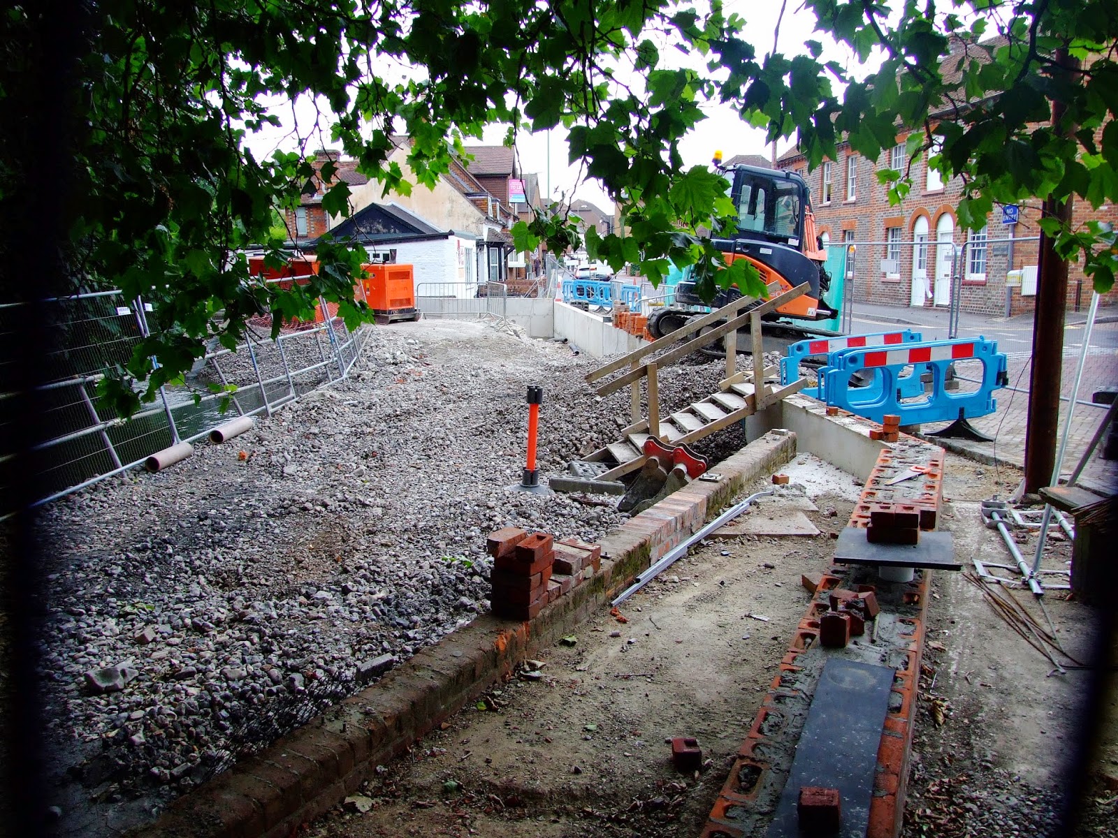
The delayed completion of works intended to protect central Newbury from 1-in-a-100 year extreme flood potential have temporarily restricted passage along the bottom section of Northcroft Stream.

The £2m Newbury Flood Alleviation Scheme (FAS) commenced in October 2012, and, as the EA currently reports, "The work was expected to be completed this spring but high groundwater levels locally and high flows in the River Kennet prevented us beginning some of the planned work until the spring. We now expect to finish on site in late summer 2013."

The access/portage point river left above the low-level pipe at the back of Island House and before Bewicks Reach cannot currently be accessed via Northcroft car park due to this area having been fenced of around a portacabin compound.

It will be interesting to see if improved access to the river has been provided once the compound is removed.

Paddling below this point would currently require exiting the river to the right almost immediately after the sluiced canal outflow by Dolton Mews as a barrage has been slung across the water course before the old slalom polls.

The new flood defence walls (and raised groundworks) at the back of Berwicks Reach are irrelevant to any thoughts of egress as these are private residence gardens.

The barrage before the old slalom polls (which now come with additional angling debris should you be thinking of playing here at a future date) on Northcroft Stream.

The barrage has been put in place to help protect the embankment enhancement wall currently being completed a little further downstream alongside Northcroft Lane between the Salvation Army Shop and the terrace of the Lock Stock & Barrel pub.  From the EA again: "We have installed a stone platform in the river near the Lock Stock and Barrel pub. This has been built to allow access for our machinery to construct a new river wall. The piled foundations for the wall are now complete and over the coming weeks we will be building the wall up to its full height."
 
The works platform has temporarily narrowed the Northcroft stream channel...
 
...but once the works have been completed the platform will be removed.
 
Any thoughts of slipping past the upstream barrage to shoot the remaining current channel might be tempered with the though of the further temporary bars to safe navigation. 

Friday, 5 July 2013

Barbel Bar wave shaping up for the sunshine

The small playable wave that forms below Barbel Bar weir was looking in nice form on the way home from work on Thursday evening.  Just right for some fun in the coming weekend sunshine...


Sunday, 7 April 2013

Minority environmental abuse on the River Kennet

Last November, this blog reported on how Access to the River Kennet at Arrowhead Road had been lost to legitimate river users, an action possibly influenced by the litter left at that location by "a minority of the public".

Another stretch of the River Kennet is now suffering from similar ongoing seasonal abuse by a small but persistent anti-social element, which is affecting a section of a navigable riverine Kennet channel, principally over a length of approximately 350m, and up to a maximum recorded extent of about 800m.

The area in question is facing the following issues.
 
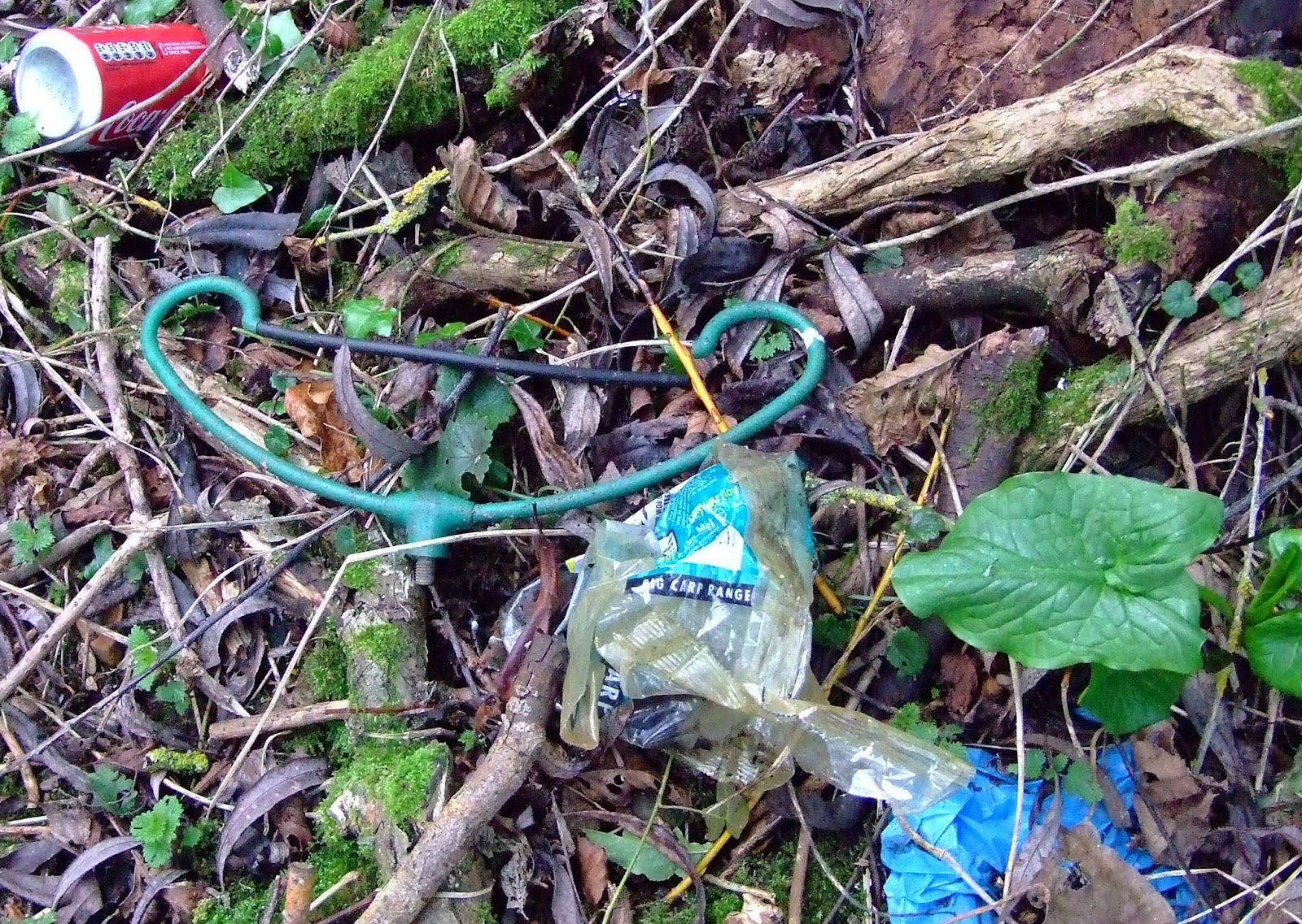
1.  General littering of the banks (which could be down to anyone), and some very specific angling related litter.
 
Luncheon meat (and a number of similar canned meat-based products) is a favourite bait for River Kennet Barbel anglers, but hey, one discarded 'tin' spotted yesterday doesn't constitute a substantial disregard for the environment...
 
 ...so lets play 'how many cans can you spot in one photograph?' (this image is from 24.03.13 and perhaps reflects an 'end of season' attitude)...
 
....or we could consider a selection of photographs from the last month.  It may be that I've seen the same rubbish before, so I've only added a small selection here.  Over the summer the undergrowth behind the access footpath will disguise previously uncleared rubbish.
 
 The length of time some of this rubbish has been left undisturbed and the process of slow decay is attested by these images from today.
 
You might think that the colour of some discarded angling equipment might help hide it from ready view, and 'excuse' those responsible for cleaning up for not having spotted it 
(assuming that those people who dumped it the first place couldn't have taken it away)...
 
...but when the undergrowth dies back you may come across the fishing umbrella equivalent to an  uncleared elephant graveyard.
 
More of the same (from January 2012)...

...and from today.

Some of the angling litter at this location is less easy to miss; this reel lying by the side of the public footpath today was not exactly hard to spot...

...and neither was this large plastic bag left beside the river.  It's a shame that the Angling Trust haven't been more rigorous in promoting their Tidy Angler project (funded by the Environment Agency, which therefore means the taxpayer is paying for a scheme that doesn't appear to be having much effect at this location).
 
Some of the angling rubbish at this site has obviously blown in from fishing lakes behind the river where anglers seek different prey, but it's a good place to escape from immediate view, which leads to point no. 2...
 
2. Human excrement.
 
Unfortunately, this is not the only example of anglers being 'caught short' on this section of the Kennet (their foresight in bringing toilet paper might be more commendable had they also thought of bringing a trowel or a bucket and bin bag too) but I think one photo is enough.  Those who may shortly be cleaning up this area might want to adopt appropriate health care precautions.
 
3. Now we come to a problem that affects all waterways, and which is an issue affecting both wildlife and paddlers when it comes to this section of the River Kennet.  Discarded and abandoned fishing tackle.
 
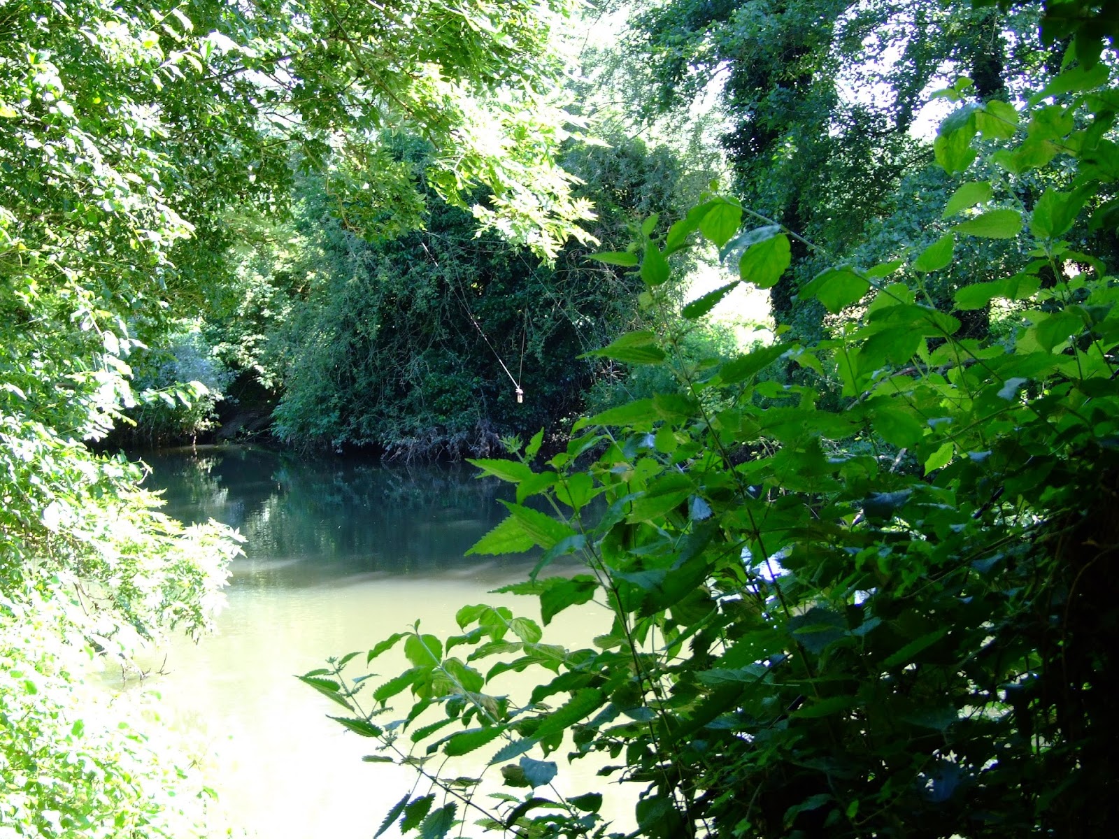
It's often really hard to see fishing line when paddling, but whilst this section of the River Kennet is only legally fished from the north bank (and therefore the fishing rights may only extend to half way across the river) that doesn't mean you won't face the possibility of snagging at any point along either side of this riverine section.
 
Most decent anglers will try to remove snagged lines (look closely at the center of this picture; so far as I'm aware the angler whose rod was still attached to this line removed it before departing)...
 
 ...but this section of the River Kennet seems to suffer from a surfeit of either myopic or vicariously thoughtless and careless anglers (this picture was taken in November 2012: it shows a fishing hook and length of fishing line at head height which was removed by a paddler from a clearly visible angling bankside location along the section of concern).  Once again, the principals of the AT's Tidy Angler project don't seem to have made much of an impression here.

More line with hook and float from today; if you think this looks fairly harmless...
 
...it's also difficult for wildlife to spot discarded fishing line as a snag hazard.  The victim in this picture, taken today, was a moorhen.
 
4.  We now come to a little recognised hazard which may be particularly relevant along this section of the River Kennet.  Underwater snagging.  The type of line and hooks shown in the pictures above are no less dangerous to wildlife when underwater.

This tree fall has remained in place for a long time during which time it has become a favoured spot for local anglers.  However, there is a risk that it has gained a considerable underwater collection of lost line and hooks. 

The words of a concerned angler best describe this issue: "Fishing to snags can be VERY productive BUT it has a shocking downside that as anglers we rarely see. I am talking about tethered fish.

Through my work within fishery management I have been involved in many snag removal projects and they are always unpopular with the anglers fishing the venue at the time. They change the appearance of the fishery and they will change the behaviour of the fish. However in the last twenty or so years I have rescued a number of tethered fish during such operations and also removed miles of line, bucketfuls of leads and of course many rigs. Sadly I have also found fish that have been tethered that have not survived."


It is the responsibility of riparian landowners (or their delegated authority) to ensure that water can flow through their land without any obstruction.  It is also a responsibility to "clear any litter and animal carcasses from the channel and banks, even if it did not come from your land."

This particular hazard can be negotiated with care by paddlers in normal flows, even when residual growth and accumulated summer foliage appears to present a curtain against downstream view.  The complaint of an angler of this section of the Kennet that this blog contains "photos of some favourite swims being cleared for passage" presumably refers to this picture from 2011:   

This is the same location as pictured in the preceding image.  The paddlers are not removing the branches in this instance, but canoeists are uniquely able to assist in clearance of river debris.  Unfortunately, and as the above quote indicates, there are those who would rather see such blockages remain in place.

Elsewhere on this stretch of the Kennet banks have been cleared to provide ease of angling access and reduce the chance of snagging, but in the following examples (pictures taken of a spot opened up to provide an additional point from which to cast a line just below the previously pictured tree falls) care for the environment does not appear to have been the priority.

Branches cut to avoid snagging would be better properly removed...

...no, lesson not learned.
 
This particular point does not assist paddlers wishing to portage here because the bank is too high.  However, there are numerous other places along the course of this channel where the banks and vegetation have been previously cleared for angling access, and which might serve for access or egress where the public footpath runs alongside the north bank (river left), or, further along the loop, in emergency need.

Where bankside clearance has already been made, access/egress for paddlers is often ideal if the location is not otherwise occupied and where it provides access to legal rights of way; a vacant peg on the River Kennet yesterday.

Just in case you haven't worked it out by now, this section of the River Kennet (and from where all of the pictures above have been taken, although there are many more from other locations along this river) is the Sulhamstead loop which runs for about 900m from Sulhamstead weir to the point where it rejoins the canal cut below Sulhamstead Lock. 

The fishing rights here are exclusively leased by the Reading and District Angling Association (RDAA).  The President of the RDAA is Martin Salter, who is also the National Campaigns Co-ordinator of the Angling Trust.  RDAA call this beat the "Lower Benyons" in deference to the owners of the estate which leases them the fishing rights here, a family of which Parliamentary Under-Secretary for Natural Environment, Water and Rural Affairs Richard Benyon MP (his ministerial portfolio includes inland waterways) is a member.

It should be emphasised that the vast majority of anglers care deeply about our rivers, and have a great deal of knowledge to share with all those who feel the same way.  There is great opportunity for all river users to work together for the benefit of the environment. The minority who are not willing to accept their responsibilities have no place by our waterways, and those who seek to use environmental arguments to exclude canoeists and kayakers from English and Welsh rivers might first wish to put their own house in order.

Friday, 5 April 2013

National exposure for the Kennet access issue

Guardian writer George Monbiot has highlighted the issue of river navigation rights with a focus on the River Kennet in his latest blog, in a piece titled "We have no right to our rivers while Richard Benyon's interests are served" [posted online Thursday 4 April 2013 13.43 BST and reproduced today on his own blog under the heading "Political Barbed Wire. Why are 97% of our rivers shut to the public? A millionaire minister’s amazing conflicts of interest give you a clue."].

Whilst the full article, complete with referenced links, is well worth a read (as are the readers comments that follow the Guardian post) selected excerpts relating to canoeing and kayaking on the River Kennet are reproduced below.

"We have no right to our rivers while Richard Benyon's interests are served

The environment minister is being permitted to oversee a highly sensitive issue in which he has an active proprietorial stake.
 
[...] Now here we go again. This article is about yet another of the minister's potential conflicts of interest.

For many years canoeists, kayakers and wild swimmers have been seeking access to the rivers of England and Wales. In Scotland, as in most parts of the world, the rivers are open to those who can navigate them. But in England and Wales, canoeists and others have formal rights of access to only 3% of our rivers: 1,400 out of 42,700 miles. Everywhere else we are told we are trespassing. We have been denied one of life's great joys: messing about on the river.

There are 2.5 million canoeists and kayakers in this country, and doubtless many more people who would like to jump in the water or take their children for a paddle. But the landlords - primarily those who own or lease the fishing rights - resolutely seek to prevent public use of this great national asset: the waterways that by right surely belong to everyone and no one.

Now here's where it gets interesting. The landowners seem to be asserting a power to exclude that they do not possess. Going back to the 15th century and beyond, there appears to be a general right of navigation on all rivers. As the campaign River Access for All points out, this right was tested in the high court in 2002 (Josie Rowland v Environment Agency, case number HC 0102371.) Mr Justice Lightman ruled that the: "Public Right of Navigation [PRN] may only be extinguished by legislation or exercise of statutory powers or by destruction of the subject matter of PRN eg through silting up of the watercourse."

As no such legislation has been passed, the public right of navigation remains in force. But because landowners and their tenants do not recognise this right, everywhere but on the 3% of rivers where it has been formally conceded, canoeists, kayakers, swimmers and the rest of the public are barred by threatening signs, barbed wire and intimidating men insisting that they are trespassing.

Canoe England, which is also campaigning for access, stresses that it is not asking to navigate every mile of brook and stream. Though canoeing has very little impact on the environment, there are a few places of particular sensitivity where it could be detrimental.

But the general claim the landowners make, that it damages fisheries, is incorrect. A study for the Environment Agency concluded that: "the consensus opinion of the assembled panel of experts is: 'Canoeing is not harmful to coarse or salmonid fish stocks in rivers'."

But the evidence is of little interest to those who refuse to share the rivers: it's not, in reality, about the sensitivities of fish; it's about excluding the great unwashed from their preserves. This is particularly the case on rivers used for very expensive trout fishing, though such sentiments also infect more popular clubs. The Angling Trust lobbies politicians to prevent the recognition of wider rights of access. It is well-placed to do so: its national campaigns co-ordinator is the former MP Martin Salter.

I suspect that on this issue and on others the trust is an embarrassment to some of the anglers it claims to represent. I have met plenty of fisherfolk who have both strong democratic instincts and a great love of wildlife, positions the Angling Trust does not appear to share. I wonder how many would support, for example, the trust's demand that the government should "authorise the trapping and lethal control" of any beavers spreading from Scotland into England. (Beavers were native to these isles until they were hunted to extinction a few centuries ago and have now been reintroduced in two areas in Scotland). I wonder how many would endorse its ecologically illiterate claim that beavers are bad for fish. Studies in both Europe and North America show that their presence in rivers boosts fish populations, as they create shelter and habitat.

As a keen angler and a keen canoeist I have, so to speak, a foot in both boats. I've fished in many of the rivers of Britain, including those frequented by kayakers and canoeists. And I have kayaked on quite a few of them as well.

Paddle down the Wye during the school holidays when - because it is among the very few rivers where canoes are permitted - the river becomes extremely busy, and you'll see a sight which immediately destroys the claim that fishing and canoeing are incompatible: trout rising all around the boats. Where fish are accustomed to them, they quickly lose their fear.

Given that it claims to encourage people to keep fit and to participate in sports, given that there appears to be no legal basis for exclusion, you might have expected the government to clarify the law and either accept the legally established general right of access or change it. But it refuses to do so. Instead it suggests that landowners and canoeists should resolve the issue through "voluntary access agreements".

The problem with voluntary access agreements is that if the landlords don't volunteer, they don't happen. Unsurprisingly they have been a flop: the British Canoe Union has been trying to strike them for nearly 50 years, and has been rebuffed almost everywhere. Without guidance from the government, the issue is resolved in favour of landlords prepared to use force or threats of force to prevent people from exercising their natural and ancient right.

The man currently responsible for the issue is Richard Benyon. During a recent interview with the Angling Trust, he said this: "There will be no change to our policy of supporting voluntary access agreements as the only way forward. Anglers and fishery owners spend a lot of time and money caring for our rivers and streams and their rights deserve to be respected."

But not apparently the rights of canoeists, whose organisations also spend a lot of time and money caring for our rivers and streams.

Benyon has sided with one constituency against another. Now why would he do that? Could it be because he owns fishing rights on the River Kennet and the River Pang?

His estate office tells me that it regards its section of the Pang as closed to kayaks and canoes (in other words "non-navigable"). Benyon leases his fishing on the Kennet to the Reading and District Angling Association (RDAA). Here, his office conceded, "the entire stretch is fully navigable by water craft." This is indisputable: the right of boats to use this water is spelt out in the 1715 Kennet Navigation Act. But has Benyon's Englefield Estate transmitted this fact to the association?

The RDAA's fisheries officer says this on its forum: "Lower Benyons from the weir downstream ... is most defenatly [sic] NON-NAVIGABLE. That means no boats, dingies, rubber rings surf boards etc etc without the landowners permission. All of which I have seen!!" He then goes on name a number of other sections of Benyon's lease which are also "defenatly NON-NAVIGABLE".

Members of the association have proposed their own solutions to the access issue, such as casting at canoes with "a three-ounce zip lead, trebles and 50lb-whiplash braid". "Trebles" means a set of three fishing hooks, welded together at opposing angles.

I would have liked to pursue the question of what advice Benyon's office has given to its tenants, but after confirming that his estate has "interests" on the Kennet and the Pang, and that it regards the Pang as closed, it told me: "We have nothing further to add to our comments."

It is wholly inappropriate that Benyon should be permitted to oversee a highly sensitive issue in which he has an active proprietorial stake. He seems incapable of standing back from his own interests. In fact the nature of his brief makes it impossible for him to do so. If he had any sense of what democracy means, and how it differs from government by the aristocracy, he would spare himself further embarrassment and stand down."

The quoted text above is © 2013 George Monbiot. 

Tuesday, 26 March 2013

Bank works and temporary barrage at Barbel Bar

As the title says...

Bank works to reinforce the south side of the River Kennet just above the weir apron at Barbel Bar present no problems for paddlers, but whilst the currently high flow rates are nearly washing out the weir, they're also making a mess of the somewhat amateurish barrage.

Paddlers should be careful to avoid the poorly identified rope line strung from the weir railings, but river left may be the best bet.  Hopefully the works will be completed soon, but in the meantime, paddle safely!

Tuesday, 15 January 2013

Paddling past the Fobney Island (very) Wetland Nature Reserve

With the River Kennet uncharacteristically maintaining above average levels, there are a few places where some of the normal restrictions on paddling have been temporarily suspended, providing a brief window of opportunity to experience a small change of tempo from the comparatively predictable experience of the Navigation's cut sections.

The Fobney Island Wetland Nature Reserve still has some way to go before it fulfils its potential as an easily accessible conservation and wildlife haven just minutes from the center of Reading, but it's already demonstrating its ability to respond as a repository of  increasingly unpredictable rain fall and river flow rates.

The temporary map at the eastern entrance to the reserve indicates the expectation that the reserve will normally maintain refuge level pools to benefit a range of fauna and flora.  Not a great photo, so the text reads as follows:

"In 2011 the Environment Agency, Reading Borough Council, Thames Water and the Thames Rivers Trust worked in partnership to improve Fobney Island for wildlife and for nature-based recreation.  The Berkshire Ornithological Club and the Reading and District Angling Association provided specialist advice throughout the project.  Previously the site was ecologically poor rough grassland.  Now, it is a mosaic of wetland, wildflower meadow, hay meadow and reed bed habitats.

The first phase of the project lowered the land to create wetland features that, at certain times of the year, will be in connection with the River Kennet to the south of the island.  This has improved the site for birds, bats, fish, reptiles and amphibians.

During spring 2012 scrub planting and grass and wildflower seeding was done to further improve the site for wildlife.

The site is divided roughly into two sections.  The Eastern Wetland features (closest to Fobney Lock) were designed to be in connection with the groundwater and should remain 'wetted' for most of the year.  In contrast, the Western wetland scrapes (towards the pylon) were formed to be in connection with the river in periods of high flow but then slowly to drain down during the spring and summer.  These scrapes are expected to be temporary or 'ephemeral' features because they are reliant on surface water.  When the river is in flood, they provide a vital temporary refuge for fish.

The river has also been restored to a more natural state through the introduction of two new riffle features - areas of shallow gravel that provide ideal spawning grounds for fish such as chub, dace and barbel. 

On the south bank of the river, lifting and thinning the crowns of the trees has let more light into the river channel.  This helps plant species to become established.  Five trees have been dropped into the river channel to create 'woody debris' features which create more diverse flows within the river.

A new footpath has also been installed to create easy public access to the Eastern Wetland site, and two bird hides provide views across the new wetland features.  There is no public access to most of the Western Wetland, to ensure undisturbed protection of wildlife.

DOG WALKERS are welcome anywhere on the Eastern Wetland, but are asked not to allow dogs to cross into the Western Wetland at any time.  A dog bin is provided at the entrance near Fobney Lock.

PLEASE KEEP THE SITE CLEAR OF ALL LITTER, which can be very harmful to wildlife. 

THE FRIENDS OF FOBNEY ISLAND is a group of volunteers who help to maintain, monitor and consult on the use of this site.  If you are interested in joining the Friends group, or helping with volunteer tasks, please call reading Borough Council's Parks Department on 0800 626540.  Please use the same number to report incidents."

Although it's not explicitly stated, there are several pieces of information contained in the above sign text which will help you judge whether to paddle down this section, but the two key factors are water levels and the time of year.  A few pictures + a little knowledge should help with the decision.

The remodelling of Fobney Island didn't include a canoe pass past the sawtooth weir but, as you portage past, the volume of water flowing over and the remaining height down to the new river level gives a good indication of whether it's good to go.

Comparative low flow (from June 2010) and high flow (from January 2013) at Fobney Weir's saw teeth.

Comparative low flow (from November 2011) and high flow (from January 2013) looking back up to Fobney Weir from the right bank put-in.

Comparative low level (from June 2010) and high level (from January 2013) bank heights at the put-in river right below Fobney Weir.

Comparative low levels (from June 2010) and high levels (from January 2013) of the River Kennet viewed from the footbridge at Fobney Weir.

Comparative low levels (from June 2010) and high levels (from January 2013) of the River Kennet viewed looking downstream of Fobney Weir pool, left bank above the top of the Western Wetland.

The above images should provide a fairly easy indication of whether there's sufficient water to paddle without scraping the bottom, particularly now that the riverine section below the weir pool the river has been remodelled with "two new riffle features - areas of shallow gravel that provide ideal spawning grounds for fish such as chub, dace and barbel." 

Dace will start spawning from early March in cold, shallow water when they congregate over gravel that is just sufficiently under water to cover them.  Once their eggs are fertilised they take about three weeks to hatch because of the lower water temperature.  Chub are similar in their spawning behaviour to Dace, but they don't get it on until somewhere between the start of May and mid-June, so their eggs only take about 3 days to hatch in the warmer water.  Barbel don't tend to spawn until between May till July.  However, whilst the eggs hatch within a week, the young Barbel continue living within the gravel for several weeks. 

What this essentially means for paddlers is that if there's not sufficient clearance with the river bed between March and August, the canalised cut is the best bypass route downstream.  This might seem frustrating when the riverine route is free of anglers between the mid-March and mid-June closed coarse fishing season, but the upside is that if there is sufficient water to make the run without environmental harm there's a good chance that it will have driven the fishing folk onto the canal. 

At times when both paddlers and anglers can use the river together, note that most fishing just below the weir will be from the left bank - even at intermediate levels the pool should be wide enough to avoid entanglement with lines - whilst once onto the narrower river section anglers now fish from the right bank and may be hidden by the trees.  If you spot a line or camo clothing at such times, normal river etiquette applies.

Once onto the river channel, beware the "five trees [that] have been dropped into the river channel to create 'woody debris' features which create more diverse flows within the river", and keep in mind that during high flows additional hazardous debris may have washed down and the number of tree 'falls' may have increased.  Keeping river left should help with safer navigation.

A potential strainer shown at high water levels on the River Kennet south of Fobney Island.

A couple of final pictures serve to demonstrate what high water levels at Fobney Island currently look like.

The view looking upstream, and west towards the flooded Western Wetland, from the unsurfaced public footpath by the riverine section of the Kennet on the Eastern Wetland section.  The river runs alongside the tree line; the ingress of water into the flooded relief pools should not be paddled. Does that pylon have a problem?

The gauge below Fobney Lock reflects what's coming down the canal cut and the riverine course.  Note that the disappearance of the mooring platform by the old pumping station is a good sign that paddling levels are good.